Latitude: 50.8349 / 50°50'5"N
Longitude: -0.2414 / 0°14'28"W
OS Eastings: 523934
OS Northings: 105402
OS Grid: TQ239054
Mapcode National: GBR JNS.KT6
Mapcode Global: FRA B6CW.RRH
Plus Code: 9C2XRQM5+XC
Entry Name: Church of St Michael
Listing Date: 19 July 1950
Grade: II*
Source: Historic England
Source ID: 1353751
English Heritage Legacy ID: 297346
ID on this website: 101353751
Location: St Michael and All Angels Church, Southwick, Adur, West Sussex, BN42
County: West Sussex
District: Adur
Electoral Ward/Division: Southwick Green
Parish: Non Civil Parish
Built-Up Area: Southwick
Traditional County: Sussex
Lieutenancy Area (Ceremonial County): West Sussex
Church of England Parish: Southwick
Church of England Diocese: Chichester
Tagged with: Church building
SOUTHWICK CHURCH LANE TQ 20 NW 3/65 (south side) 19.7.50 Church of St Michael II*
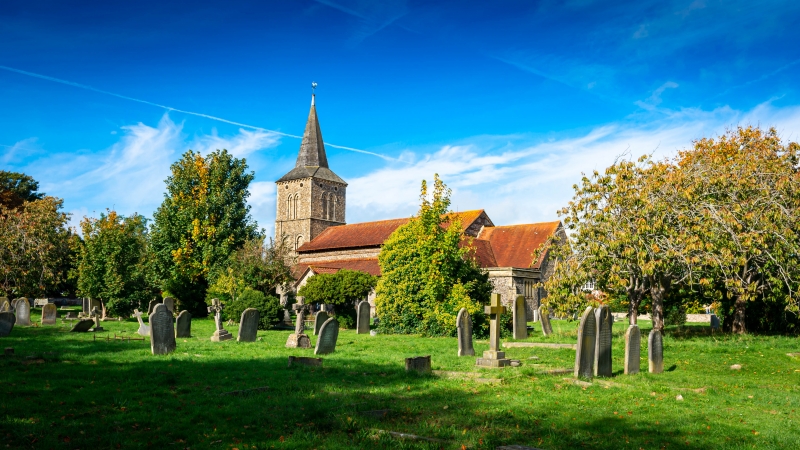
Church. C12 and C13, 1835 by John Garret. Rebuilt in 1949 by John Denman. Coursed and uncoursed cobblestone with plain tiled and pantiled roofs. Tower with side vestries, nave with south porch, and aisles, chancel. Three stage tower and shingled broach spire. First stage reputed to be Saxon, with flanking round-ended vestries of 1949. Renewed round-headed west door with recessed arches on piers. Second stage with wide paired round-headed arches on columns. Third stage with narrow, very tall lancets and round-openings above. Four bay nave of 1835, with simple tripartite lancets. Chancel with much renewed C13 lancets Interior: screen, C14, wood narrow bays. Monument: cartouche, Elizabeth Gray, d. 1745. Tower taken down as a result of bomb damage in 1941.
Listing NGR: TQ2393405402
External links are from the relevant listing authority and, where applicable, Wikidata. Wikidata IDs may be related buildings as well as this specific building. If you want to add or update a link, you will need to do so by editing the Wikidata entry.


Other nearby listed buildings