Latitude: 50.9297 / 50°55'46"N
Longitude: -0.2723 / 0°16'20"W
OS Eastings: 521513
OS Northings: 115890
OS Grid: TQ215158
Mapcode National: GBR HL8.PYX
Mapcode Global: FRA B69N.CR6
Plus Code: 9C2XWPHH+V3
Entry Name: The George Hotel
Listing Date: 9 May 1980
Grade: II
Source: Historic England
Source ID: 1353963
English Heritage Legacy ID: 298429
ID on this website: 101353963
Location: Henfield, Horsham, West Sussex, BN5
County: West Sussex
District: Horsham
Civil Parish: Henfield
Built-Up Area: Henfield
Traditional County: Sussex
Lieutenancy Area (Ceremonial County): West Sussex
Church of England Parish: Henfield St Peter
Church of England Diocese: Chichester
Tagged with: Hotel
HENFIELD HIGH STREET 1. (east side) 5404 The George Hotel TQ 2115 20/247
II GV
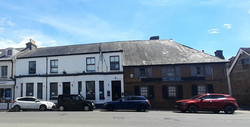
2. The main portion of this building is Cl9. Two storeys. Four windows. Stuccoed. Slate roof but the south end is C17 or earlier timber-framed buildings, refaced in C18 with red brick and grey headers alternately, but some of the timbering exposed behind. Stringcourse. Slate roof. Glazing bars intact on ground floor only.
Listing NGR: TQ2151315890
External links are from the relevant listing authority and, where applicable, Wikidata. Wikidata IDs may be related buildings as well as this specific building. If you want to add or update a link, you will need to do so by editing the Wikidata entry.


Other nearby listed buildings