Latitude: 51.078 / 51°4'40"N
Longitude: -0.3215 / 0°19'17"W
OS Eastings: 517675
OS Northings: 132307
OS Grid: TQ176323
Mapcode National: GBR HJG.9J6
Mapcode Global: FRA B668.QJG
Plus Code: 9C3X3MHH+69
Entry Name: Dendy's
Listing Date: 4 October 1985
Grade: II
Source: Historic England
Source ID: 1354275
English Heritage Legacy ID: 299741
ID on this website: 101354275
Location: The Common, Horsham, West Sussex, RH12
County: West Sussex
District: Horsham
Civil Parish: North Horsham
Built-Up Area: Horsham
Traditional County: Sussex
Lieutenancy Area (Ceremonial County): West Sussex
Church of England Parish: Holbrook, St Mark
Church of England Diocese: Chichester
Tagged with: Building
HORSHAM RURAL HEATH WAY 1. 5404
TQ 13 SE 7/210 Dendy's
II
2.
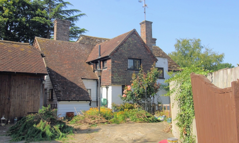
Sometimes spelt 'Denbys'. House. C17. Whitewashed rubble, stone slate roof. Two storeys, three bays. Windows are all casements with leaded lights. Small gabled stone porch to door in central bay. Two chimneys, that at left on ridge of brick with moulded cap; the lower part of the shaft, insert into the gable wall, is tile hung. The right hand stack is external and of stone to the point at which the roof is half hipped. Probably later rear wing is tiled with flat-roofed extension.
Listing NGR: TQ1767532307
External links are from the relevant listing authority and, where applicable, Wikidata. Wikidata IDs may be related buildings as well as this specific building. If you want to add or update a link, you will need to do so by editing the Wikidata entry.


Other nearby listed buildings