Latitude: 50.8418 / 50°50'30"N
Longitude: -0.7813 / 0°46'52"W
OS Eastings: 485904
OS Northings: 105402
OS Grid: SU859054
Mapcode National: GBR DGS.19L
Mapcode Global: FRA 967W.5FV
Plus Code: 9C2XR6R9+PF
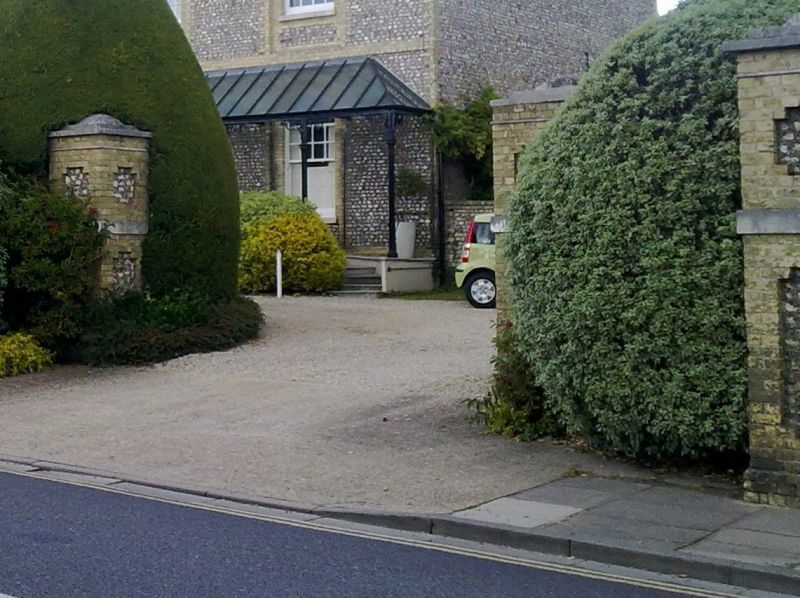
Entry Name: Walls and Gate Piers to West of St Paul's Vicarage
Listing Date: 8 October 1971
Grade: II
Source: Historic England
Source ID: 1354350
English Heritage Legacy ID: 300134
ID on this website: 101354350
Location: Chichester, West Sussex, PO19
County: West Sussex
District: Chichester
Civil Parish: Chichester
Built-Up Area: Chichester
Traditional County: Sussex
Lieutenancy Area (Ceremonial County): West Sussex
Church of England Parish: Chichester St Paul
Church of England Diocese: Chichester
Tagged with: Wall
ST PAUL'S ROAD 1. 972 (North-East Side) Walls and gate piers to west of St Paul's Vicarage SU 8505 SE 1/554A II 2. Walls of flint with galletted flint and yellow brick capping. Piers of yellow brick with inserted panels of flint; segmental finials and capping.
Listing NGR: SU8590405402
External links are from the relevant listing authority and, where applicable, Wikidata. Wikidata IDs may be related buildings as well as this specific building. If you want to add or update a link, you will need to do so by editing the Wikidata entry.


Other nearby listed buildings