Approximate Location Map
Large Map »
Latitude: 50.9702 / 50°58'12"N
Longitude: -0.883 / 0°52'58"W
OS Eastings: 478528
OS Northings: 119571
OS Grid: SU785195
Mapcode National: GBR CCR.5L3
Mapcode Global: FRA 961K.1TH
Plus Code: 9C2XX4C8+3R
Entry Name: The High House, South Harting
Listing Date: 18 June 1959
Grade: II
Source: Historic England
Source ID: 1354725
English Heritage Legacy ID: 301833
ID on this website: 101354725
Location: South Harting, Chichester, West Sussex, GU31
County: West Sussex
District: Chichester
Civil Parish: Harting
Built-Up Area: South Harting
Traditional County: Sussex
Lieutenancy Area (Ceremonial County): West Sussex
Church of England Parish: Harting St Mary and St Gabriel
Church of England Diocese: Chichester
Tagged with: Architectural structure
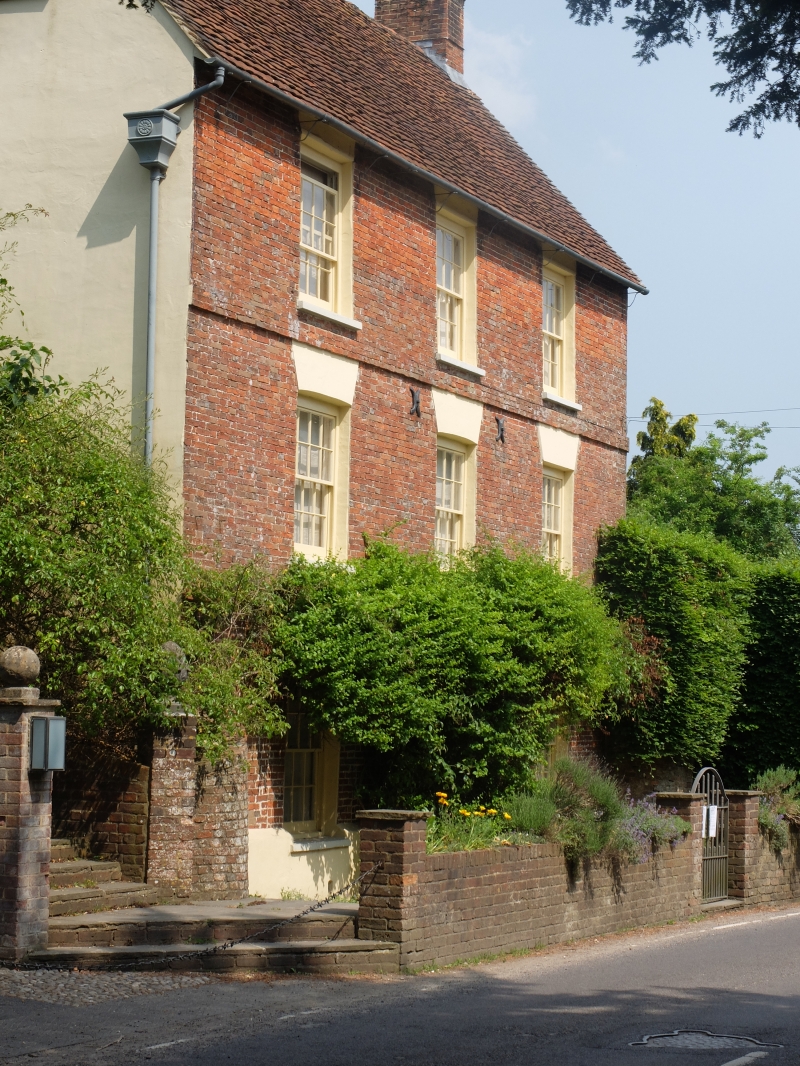
SU 7819-7919 HARTING PETERSFIELD ROAD
South Harting
28/26 The High House
18.6.59
II
House. C18. Red brick and grey headers. Stringcourse. Tiled roof. Glazing
bars intact. Doorway with flat hood on brackets.
Listing NGR: SU7852819571
External links are from the relevant listing authority and, where applicable, Wikidata. Wikidata IDs may be related buildings as well as this specific building. If you want to add or update a link, you will need to do so by editing the Wikidata entry.


Other nearby listed buildings
