Approximate Location Map
Large Map »
Latitude: 51.0475 / 51°2'51"N
Longitude: -0.0584 / 0°3'30"W
OS Eastings: 536196
OS Northings: 129367
OS Grid: TQ361293
Mapcode National: GBR KMV.B1F
Mapcode Global: FRA B6RB.YYJ
Plus Code: 9C3X2WXR+2J
Entry Name: Upper Sheriff
Listing Date: 11 May 1983
Grade: II
Source: Historic England
Source ID: 1354899
English Heritage Legacy ID: 302821
ID on this website: 101354899
Location: Highbrook, Mid Sussex, RH17
County: West Sussex
District: Mid Sussex
Civil Parish: West Hoathly
Traditional County: Sussex
Lieutenancy Area (Ceremonial County): West Sussex
Church of England Parish: Highbrook All Saints
Church of England Diocese: Chichester
Tagged with: Architectural structure
1.
5405
TQ 32 NE
12/525
WEST HOATHLY
HAMMINGDEN LANE
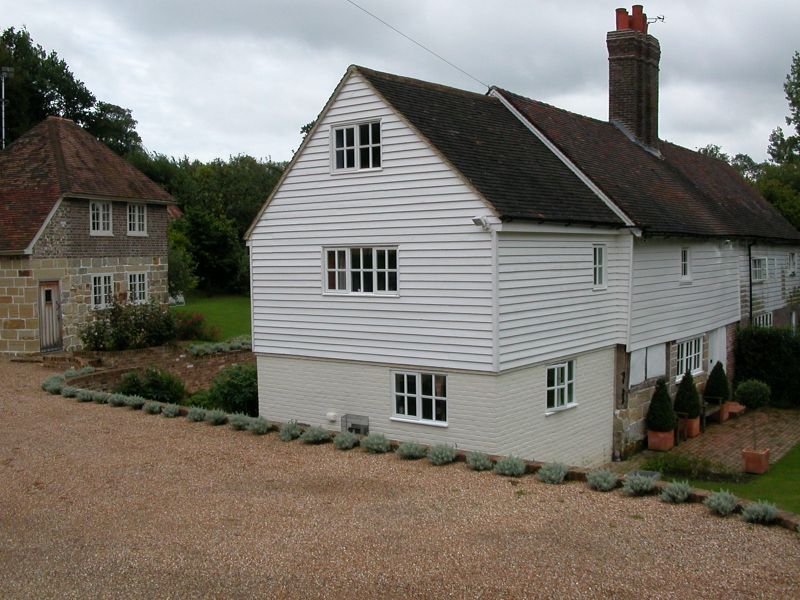
Upper Sheriff
II
2.
C18 or earlier. Two storeys. Three windows. Ground floor red brick,
above faced with weather-boarding. Tiled roof. Casement windows.
Listing NGR: TQ3619629367
External links are from the relevant listing authority and, where applicable, Wikidata. Wikidata IDs may be related buildings as well as this specific building. If you want to add or update a link, you will need to do so by editing the Wikidata entry.


Other nearby listed buildings
