Latitude: 55.042 / 55°2'31"N
Longitude: -1.5311 / 1°31'51"W
OS Eastings: 430062
OS Northings: 572044
OS Grid: NZ300720
Mapcode National: GBR KBR4.BC
Mapcode Global: WHC3D.GJ4L
Plus Code: 9C7W2FR9+RH
Entry Name: Backworth Miners Welfare Hall
Listing Date: 8 February 1949
Last Amended: 19 February 1986
Grade: II
Source: Historic England
Source ID: 1354995
English Heritage Legacy ID: 303263
ID on this website: 101354995
Location: Backworth, North Tyneside, Tyne and Wear, NE27
County: North Tyneside
Electoral Ward/Division: Valley
Parish: Non Civil Parish
Built-Up Area: Backworth
Traditional County: Northumberland
Lieutenancy Area (Ceremonial County): Tyne and Wear
Church of England Parish: Earsdon and Backworth
Church of England Diocese: Newcastle
Tagged with: Architectural structure
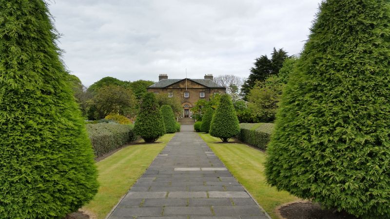
SEATON VALLEY (part) B1322 (west side) NZ 37 SW Backworth. 4/19 Backworth Miners' Welfare Hall 8.2.49 (formerly listed as Backworth Hall) G.V. II House, now club. Dated 1778 on rainwater head. By William Newton for R.W.Grey. Sand- stone ashlar; graduated Lakeland slate roof, rendered chimneys. Basement and 2 storeys, 5 x 5 bays with wings of one storey, 5 bays; of the right wing only the facade survives. Central renewed double door and fanlight recessed in Venetian doorcase. Rusticated basement. Sash windows with glazing bars, those on upper floors in architraves; ground floor windows have fluted friezes and cornices, with pediments to those in bays 2 and 4. Ground floor and sill bands; dentilled eaves cornice continuing across pediment over central 3 bays; blocking course. Rear central pediment. Hipped roof. Wings: arcaded, central 3 bays project slightly; doors in outer bays blocked except at right in left wing. Interior: entrance hall has Venetian arch; cast iron grate and radiating-patterned hearth in ground floor left room. Interior gutted by fire.
Listing NGR: NZ3006272044
External links are from the relevant listing authority and, where applicable, Wikidata. Wikidata IDs may be related buildings as well as this specific building. If you want to add or update a link, you will need to do so by editing the Wikidata entry.


Other nearby listed buildings