Approximate Location Map
Large Map »
Latitude: 51.0393 / 51°2'21"N
Longitude: -1.7046 / 1°42'16"W
OS Eastings: 420804
OS Northings: 126699
OS Grid: SU208266
Mapcode National: GBR 51R.MWD
Mapcode Global: FRA 769C.RQ5
Plus Code: 9C3W27QW+P4
Entry Name: Emmott's Farmhouse
Listing Date: 28 March 1985
Grade: II
Source: Historic England
Source ID: 1355733
English Heritage Legacy ID: 319477
ID on this website: 101355733
Location: West Grimstead, Wiltshire, SP5
County: Wiltshire
Civil Parish: Grimstead
Built-Up Area: West Grimstead
Traditional County: Wiltshire
Lieutenancy Area (Ceremonial County): Wiltshire
Church of England Parish: West Grimstead St John
Church of England Diocese: Salisbury
Tagged with: Farmhouse
SU 22 NW GRIMSTEAD WEST GRIMSTEAD
(north side)
6/97 Emmott's Farmhouse
GV II
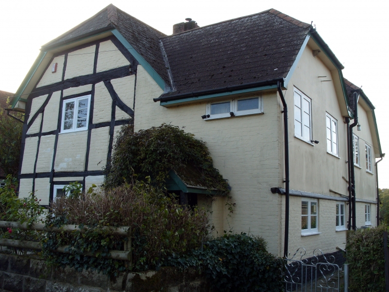
Farmhouse. Early C17 with C18 outshut, C20 alterations. Square
panelled timber-framing with brick nogging replacing wattle and
daub, concrete tiled roof with brick stack. 2-room plan with
central stack, oushut added in C18. Gable end to road, with
entrance in outshut and another on left return. 2-storey, 1-window
front has C20 porch with C20 casements to ground and first floors;
the right part being outshut with raised roof of cl950 and to left
timber-framing with slightly curved bracing. Left return has one
C20 casement to ground and first floors, in main timber-framed
elevation. Rear has rebuilt brick wall of c1945. Right return has
C19 cast-iron casements to ground floor and 1950's first floor; not
of special interest.
Interior: Central back-to-back fireplace is brick with timber
lintels. Exposed wattle and daub on first floor in timber-framed
right return, now in outshut, but former outside wall. (Unpublished
recordsofR.C.H.M. (England), Salisbury)
Listing NGR: SU2080426699
External links are from the relevant listing authority and, where applicable, Wikidata. Wikidata IDs may be related buildings as well as this specific building. If you want to add or update a link, you will need to do so by editing the Wikidata entry.


Other nearby listed buildings
