Latitude: 51.582 / 51°34'55"N
Longitude: -1.7458 / 1°44'44"W
OS Eastings: 417708
OS Northings: 187050
OS Grid: SU177870
Mapcode National: GBR YXK.QS
Mapcode Global: VHB3F.PHFK
Plus Code: 9C3WH7J3+RM
Entry Name: The Wheatsheaf
Listing Date: 20 September 1979
Grade: II
Source: Historic England
Source ID: 1355906
English Heritage Legacy ID: 318556
ID on this website: 101355906
Location: Lower Stratton, Swindon, Wiltshire, SN3
County: Swindon
Civil Parish: Stratton St Margaret
Built-Up Area: Swindon
Traditional County: Wiltshire
Lieutenancy Area (Ceremonial County): Wiltshire
Church of England Parish: Stratton St Margaret
Church of England Diocese: Bristol
Tagged with: Architectural structure
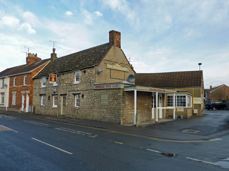
1.
5410 STRATTON ST MARGARET ERMIN STREET
(north-east side)
No 167 The Wheatsheaf
SU 18 NE 8/458
II
2.
C18 modernized. Two storeys, pebbledash. Stone tile roof with gable end
brick chimneys, modern on left hand side. Three ranges of late C19 glazing
bar sashes with modern lintels. Interior and rear elevation altered.
Listing NGR: SU1770887050
External links are from the relevant listing authority and, where applicable, Wikidata. Wikidata IDs may be related buildings as well as this specific building. If you want to add or update a link, you will need to do so by editing the Wikidata entry.


Other nearby listed buildings