Latitude: 51.5836 / 51°35'1"N
Longitude: -2.1725 / 2°10'20"W
OS Eastings: 388144
OS Northings: 187211
OS Grid: ST881872
Mapcode National: GBR 1PK.PJX
Mapcode Global: VH95R.9GBB
Plus Code: 9C3VHRMH+F2
Entry Name: Barns and Attached Range of Outbuildings to the East of Ruckley House
Listing Date: 12 December 1951
Last Amended: 3 December 1986
Grade: II
Source: Historic England
Source ID: 1356035
English Heritage Legacy ID: 318024
ID on this website: 101356035
Location: Easton Grey, Wiltshire, SN16
County: Wiltshire
Civil Parish: Easton Grey
Traditional County: Wiltshire
Lieutenancy Area (Ceremonial County): Wiltshire
Church of England Parish: Easton Grey
Church of England Diocese: Bristol
Tagged with: Barn
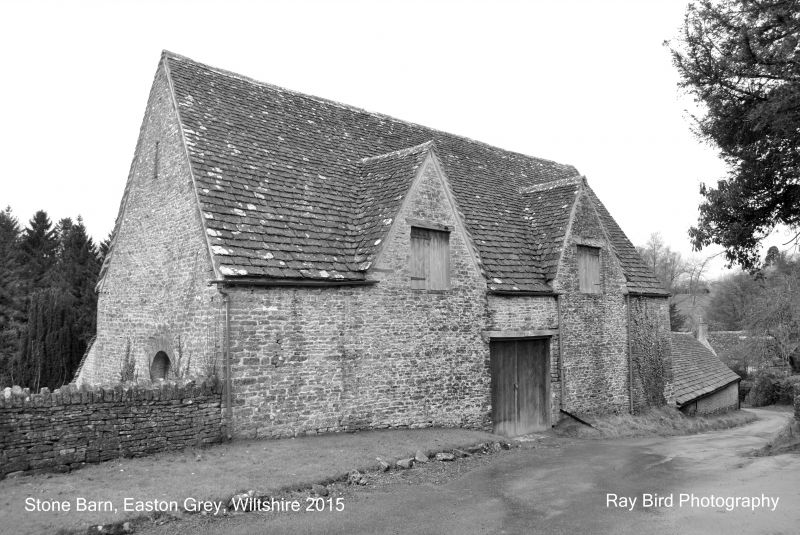
EASTON GREY THE STREET ST 88 NE (east side) 3/27 Barns and attached range of outbuildings to the east of 12.12.51 Ruckley House (formerly listed as Barn at Ruckleyhill Farm) GV II
Two Barns, Loose Boxes and Cowsheds. Large barn to left-hand probably of C17 origin, remainder C18 and C19 with alterations in the early C20. One long range on the east side of courtyard all of coursed rubble with stone slate roofs except loose box section nearest garage (former cowshed) which is of brick with cement render. Large barn has central full-height midstrey to west facade with plank gates. Later outshut to right-hand with 2 casement windows. Carriage entrance on east facade with large wooden lintel and plank gates; 2 window openings. Small barn has steps up to loft. Cowshed to the south end has circular stone piers. Plank gates and 6-pane sashes to loose boxes. Interior. Roof structure to large barn completely renewed.
Listing NGR: ST8814487211
External links are from the relevant listing authority and, where applicable, Wikidata. Wikidata IDs may be related buildings as well as this specific building. If you want to add or update a link, you will need to do so by editing the Wikidata entry.


Other nearby listed buildings