Latitude: 51.5829 / 51°34'58"N
Longitude: -1.8616 / 1°51'41"W
OS Eastings: 409684
OS Northings: 187128
OS Grid: SU096871
Mapcode National: GBR 3SM.Q53
Mapcode Global: VHB3C.PG6W
Plus Code: 9C3WH4MQ+59
Entry Name: Haskins Monument in Churchyard, 24 Metres South of South Porch, Church of St Mary
Listing Date: 17 April 1986
Grade: II
Source: Historic England
Source ID: 1356059
English Heritage Legacy ID: 317943
ID on this website: 101356059
Location: St Mary's Church, Church End, Wiltshire, SN5
County: Wiltshire
Civil Parish: Purton
Traditional County: Wiltshire
Lieutenancy Area (Ceremonial County): Wiltshire
Church of England Parish: Purton
Church of England Diocese: Bristol
Tagged with: Monument
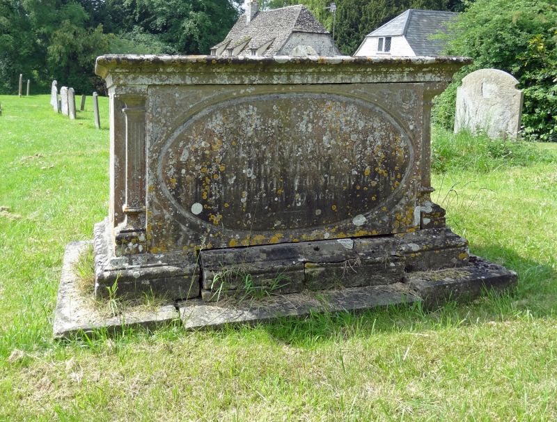
SU 08 NE PURTON CHURCH END
8/295 Haskins monument in churchyard, 2m
south of south porch, Church of
St. Mary
GV II
Chest tomb. Early C18. Sandstone. Moulded table with fascia and
moulded base. Recessed corner balusters. Inscription within oval
moulded panel, to JOHN HASKINS, died 1813.
Listing NGR: SU0968487128
External links are from the relevant listing authority and, where applicable, Wikidata. Wikidata IDs may be related buildings as well as this specific building. If you want to add or update a link, you will need to do so by editing the Wikidata entry.


Other nearby listed buildings