Approximate Location Map
Large Map »
Latitude: 53.4111 / 53°24'39"N
Longitude: -2.9449 / 2°56'41"W
OS Eastings: 337287
OS Northings: 390891
OS Grid: SJ372908
Mapcode National: GBR 7DM.Y6
Mapcode Global: WH877.QJVB
Plus Code: 9C5VC364+C2
Entry Name: 15, Deane Road
Listing Date: 14 November 1974
Last Amended: 19 June 1985
Grade: II
Source: Historic England
Source ID: 1356320
English Heritage Legacy ID: 214003
ID on this website: 101356320
Location: Kensington, Liverpool, Merseyside, L7
County: Liverpool
Electoral Ward/Division: Kensington and Fairfield
Parish: Non Civil Parish
Built-Up Area: Liverpool
Traditional County: Lancashire
Lieutenancy Area (Ceremonial County): Merseyside
Church of England Parish: Liverpool, All Saints
Church of England Diocese: Liverpool
Tagged with: Building
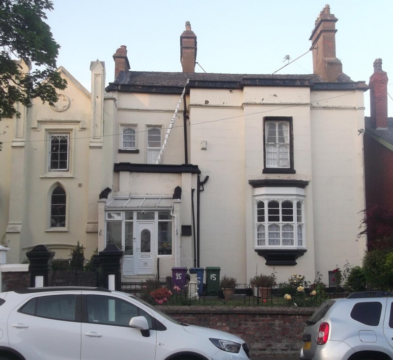
SJ 3790 DEANE ROAD
L7
28/366 No. 15
(formerly listed
14.11.74 with No. 13)
G.V. II
House. 1840s. Stucco with slate roof. 2 storeys and 2 bays;
1st bay recessed, 2nd bay has projecting centre. Top cornice
and coped parapet. Ground floor window has canted oriel in
chamfered reveals. Mullioned and transomed casements have 4-
centred arched lights. 1st floor has paired windows to 1st
bay and 2-light window to 2nd bay. Projecting entrance has
buttresses. Segmental-headed entrance with paired half-
glazed doors and later red brick glazed porch.
Listing NGR: SJ3728790891
External links are from the relevant listing authority and, where applicable, Wikidata. Wikidata IDs may be related buildings as well as this specific building. If you want to add or update a link, you will need to do so by editing the Wikidata entry.


Other nearby listed buildings
