Latitude: 53.4756 / 53°28'32"N
Longitude: -2.1506 / 2°9'2"W
OS Eastings: 390098
OS Northings: 397668
OS Grid: SJ900976
Mapcode National: GBR FXF7.5S
Mapcode Global: WHB9H.YW1W
Plus Code: 9C5VFRGX+7P
Entry Name: 33-36, Fairfield Square
Listing Date: 17 November 1966
Last Amended: 14 July 1987
Grade: II
Source: Historic England
Source ID: 1356490
English Heritage Legacy ID: 212735
ID on this website: 101356490
Location: Droylsden, Tameside, Greater Manchester, M43
County: Tameside
Electoral Ward/Division: Droylsden East
Parish: Non Civil Parish
Built-Up Area: Droylsden
Traditional County: Lancashire
Lieutenancy Area (Ceremonial County): Greater Manchester
Church of England Parish: Droylsden St Mary
Church of England Diocese: Manchester
Tagged with: Building
DROYLSDEN FAIRFIELD SQUARE SJ 99 NW
4/79 Nos. 33 to 36 (consecutive) (formerly listed as Nos 33, 34, 35, 36, 37, 37A, 17/11/66 38, 39, 40)
G.V. II
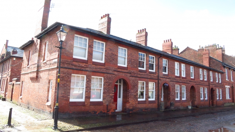
4 houses. c.1910-1914. Brick with slate roof. Total of 14 bays and 2 storeys. Doors in each third bay have leaded glass panels. Recessed porches with semi-circular heads. A first floor band rises above the porches. 10 ground and 14 first floor windows have flat brick heads, brick sills and sashes in which the upper sash has 6 panes and the lower 1 pane. Hipped roof with 4 ridge chimney stacks. Included for group value and as an integral part of the Fairfield Moravian settlement.
Listing NGR: SJ9009897668
External links are from the relevant listing authority and, where applicable, Wikidata. Wikidata IDs may be related buildings as well as this specific building. If you want to add or update a link, you will need to do so by editing the Wikidata entry.


Other nearby listed buildings