Approximate Location Map
Large Map »
Latitude: 51.1632 / 51°9'47"N
Longitude: 1.2369 / 1°14'12"E
OS Eastings: 626414
OS Northings: 145415
OS Grid: TR264454
Mapcode National: GBR W15.1JH
Mapcode Global: VHLH9.D185
Plus Code: 9F33567P+7Q
Entry Name: 138 and 140, Canterbury Road
Listing Date: 31 July 1975
Grade: II
Source: Historic England
Source ID: 1356611
English Heritage Legacy ID: 178608
ID on this website: 101356611
Location: Lydden, Dover, Kent, CT15
County: Kent
District: Dover
Civil Parish: Lydden
Built-Up Area: Lydden
Traditional County: Kent
Lieutenancy Area (Ceremonial County): Kent
Tagged with: Building Thatched cottage
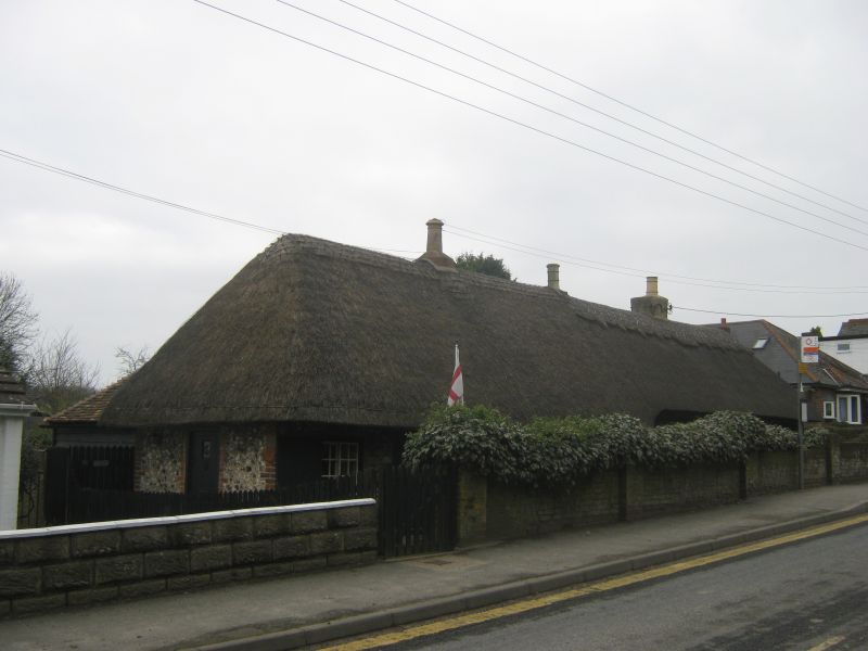
TR 24 NE LYDDEN CANTERBURY ROAD
(north side)
2/79
Nos. 138 and 140
31.7.75
II
Cottage pair. Circa 1800. Flint with red brick dressings and thatched roof.
Built in 2 stages. One storey with hipped roof, the eaves line at 2 levels,
stepped up to right, with stacks to left, centre and right. Three shuttered
horizontally sliding glazing bar sashes to each cottage, with boarded doors
to left and right.
Listing NGR: TR2641545414
External links are from the relevant listing authority and, where applicable, Wikidata. Wikidata IDs may be related buildings as well as this specific building. If you want to add or update a link, you will need to do so by editing the Wikidata entry.


Other nearby listed buildings
