Latitude: 53.6067 / 53°36'24"N
Longitude: -2.6063 / 2°36'22"W
OS Eastings: 359982
OS Northings: 412408
OS Grid: SD599124
Mapcode National: GBR BV7Q.KT
Mapcode Global: WH97K.YL3W
Plus Code: 9C5VJ94V+MF
Entry Name: Leeds and Liverpool Canal Aqueduct over River Douglas
Listing Date: 19 August 1986
Grade: II
Source: Historic England
Source ID: 1356780
English Heritage Legacy ID: 210489
ID on this website: 101356780
Location: Bolton, Greater Manchester, PR7
County: Lancashire
District: Chorley
Civil Parish: Blackrod
Built-Up Area: Adlington
Traditional County: Lancashire
Lieutenancy Area (Ceremonial County): Lancashire
Church of England Parish: Blackrod St Katharine
Church of England Diocese: Manchester
BLACKROD LEEDS AND LIVERPOOL SD 51 SE CANAL
2/8 Aqueduct over River Douglas - - II
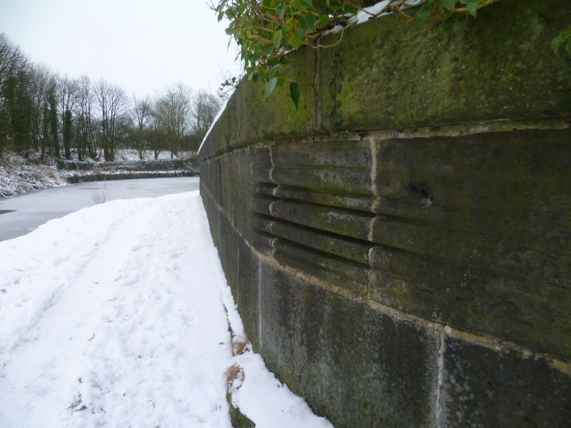
Aqueduct. 1790s. Built for Lancaster Canal south branch, engineer John Rennie. Rock-faced stone with ashlar dressings and abutments. Round arch; cornice and coped parapet. Abutments swept out at base. Aqueduct has 2 tow paths, that to south shows wear to parapet from tow ropes.
Listing NGR: SD5998212408


Other nearby listed buildings