Approximate Location Map
Large Map »
Latitude: 51.5382 / 51°32'17"N
Longitude: -0.1798 / 0°10'47"W
OS Eastings: 526333
OS Northings: 183716
OS Grid: TQ263837
Mapcode National: GBR 32.TR
Mapcode Global: VHGQR.TLSN
Plus Code: 9C3XGRQC+73
Entry Name: 16, Clifton Hill NW8
Listing Date: 9 January 1970
Grade: II
Source: Historic England
Source ID: 1356953
English Heritage Legacy ID: 209241
ID on this website: 101356953
Location: South Hampstead, Westminster, London, NW8
County: London
District: City of Westminster
Electoral Ward/Division: Abbey Road
Parish: Non Civil Parish
Built-Up Area: City of Westminster
Traditional County: Middlesex
Lieutenancy Area (Ceremonial County): Greater London
Church of England Parish: Kilburn St Mary
Church of England Diocese: London
Tagged with: Building
TQ 2683 NW CITY OF WESTMINSTER CLIFTON HILL, NW8
2/21 (north side)
9.1.70
No 16
GV II
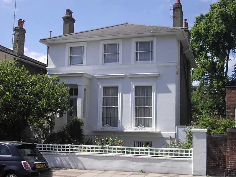
Detached villa. Circa 1840. Stucco. Hipped slate roof to eaves. 2 storeys and
basement. 3 windows wide. Steps to left hand entrance in projecting pilastered
porch. Panelled doors. Square headed architraved sashes, corniced to ground
floor. Plate glass with margin glazing to upper floor. Cast iron ground floor
window guards. Part of unusually complete surviving layout.
Listing NGR: TQ2633383716
External links are from the relevant listing authority and, where applicable, Wikidata. Wikidata IDs may be related buildings as well as this specific building. If you want to add or update a link, you will need to do so by editing the Wikidata entry.


Other nearby listed buildings
