Latitude: 53.0284 / 53°1'42"N
Longitude: -2.6063 / 2°36'22"W
OS Eastings: 359432
OS Northings: 348071
OS Grid: SJ594480
Mapcode National: GBR 7P.F9DB
Mapcode Global: WH9BG.Y42Q
Plus Code: 9C5V29HV+9F
Entry Name: Wrenbury Church Bridge
Listing Date: 19 May 1986
Grade: II*
Source: Historic England
Source ID: 1357482
English Heritage Legacy ID: 422451
ID on this website: 101357482
Location: Wrenbury-cum-Frith, Cheshire East, Cheshire, CW5
County: Cheshire East
Civil Parish: Wrenbury cum Frith
Built-Up Area: Wrenbury-cum-Frith
Traditional County: Cheshire
Lieutenancy Area (Ceremonial County): Cheshire
Church of England Parish: Wrenbury St Margaret
Church of England Diocese: Chester
Tagged with: Bridge Road bridge Draw bridge
In the entry for WRENBURY CUM FRITH SHROPSHIRE UNION SJ 54 NE CANAL Wrenbury Church Bridge 2/88 II The grade shall be amended to read Grade II*
------------------------------------
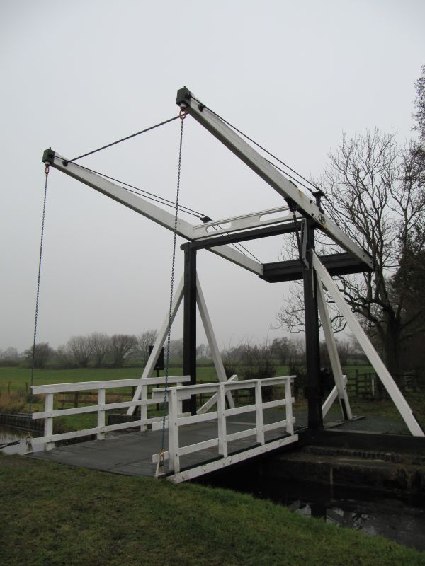
WRENBURY CUM FRITH C.P. SHROPSHIRE UNION CANAL SJ 54 NE 2/88 Wrenbury Church Bridge II Farm bridge. c.1790. By Thomas Telford. Timber. Single span. A wooden platform formed of planks laid between timber beams spans the river at the level of the bank. This is hinged at its northern edge and raised and lowered by a counterbalancing beam weight which is supported by two posts of square section on the northern bank, which carry two horizontal beams which have chains to their southern ends connecting with the platform of the bridge and a weight to their northern end. Iron tension rods run from the vertical beams to the ends of the horizontal beams. There are 3 such bridges in the parish.
Listing NGR: SJ5943248070
External links are from the relevant listing authority and, where applicable, Wikidata. Wikidata IDs may be related buildings as well as this specific building. If you want to add or update a link, you will need to do so by editing the Wikidata entry.


Other nearby listed buildings