Approximate Location Map
Large Map »
Latitude: 51.4938 / 51°29'37"N
Longitude: -0.1075 / 0°6'27"W
OS Eastings: 531475
OS Northings: 178907
OS Grid: TQ314789
Mapcode National: GBR NL.0P
Mapcode Global: VHGR0.3Q06
Plus Code: 9C3XFVVR+GX
Entry Name: Boundary Stone to Side of Number 66
Listing Date: 27 March 1981
Grade: II
Source: Historic England
Source ID: 1357965
English Heritage Legacy ID: 204744
ID on this website: 101357965
Location: Lambeth, London, SE11
County: London
District: Lambeth
Electoral Ward/Division: Prince's
Parish: Non Civil Parish
Built-Up Area: Lambeth
Traditional County: Surrey
Lieutenancy Area (Ceremonial County): Greater London
Church of England Parish: North Lambeth
Church of England Diocese: Southwark
Tagged with: Boundary marker
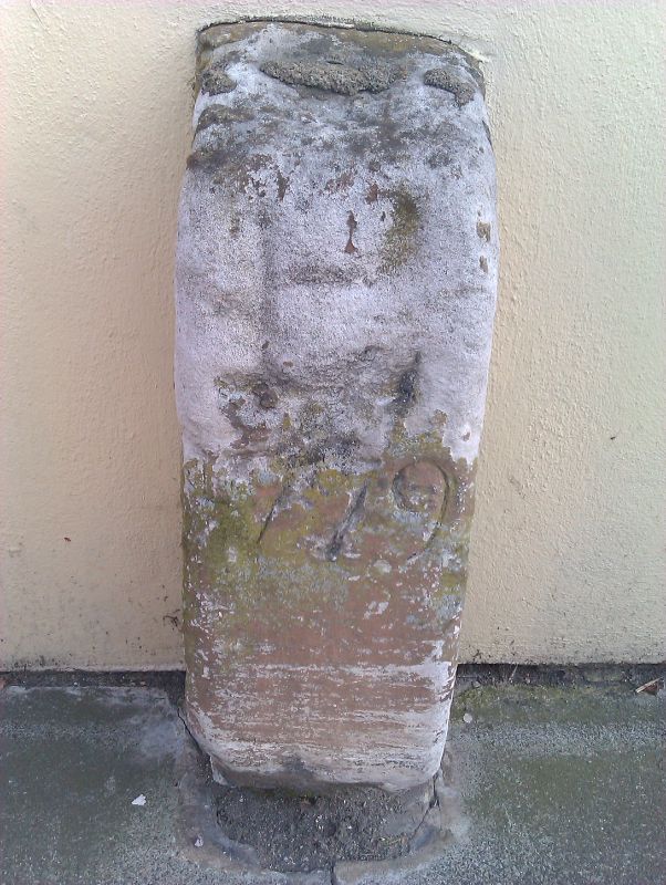
WALCOT SQUARE SE11
1. (south side)
5023
Boundary Stone to side
of No 66
TQ 3178 5/1009
II
2.
Stone post dated 1779 with monogram PL.
Listing NGR: TQ3147578907
External links are from the relevant listing authority and, where applicable, Wikidata. Wikidata IDs may be related buildings as well as this specific building. If you want to add or update a link, you will need to do so by editing the Wikidata entry.


Other nearby listed buildings
