Approximate Location Map
Large Map »
Latitude: 51.4943 / 51°29'39"N
Longitude: -0.187 / 0°11'13"W
OS Eastings: 525953
OS Northings: 178822
OS Grid: TQ259788
Mapcode National: GBR 2L.6H
Mapcode Global: VHGQY.PPZT
Plus Code: 9C3XFRV7+P5
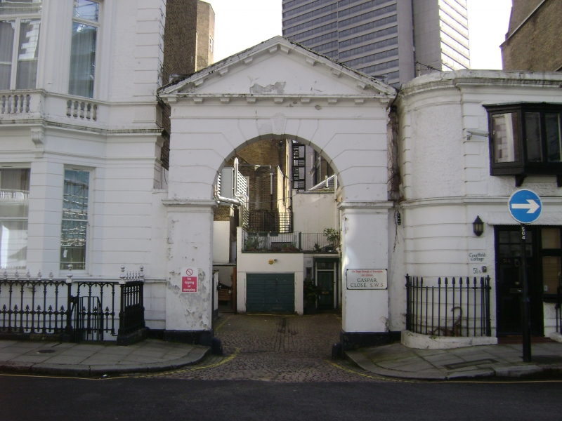
Entry Name: Entrance Arch from Courtfield Gardens
Listing Date: 6 August 1973
Grade: II
Source: Historic England
Source ID: 1358151
English Heritage Legacy ID: 203795
ID on this website: 101358151
Location: South Kensington, Kensington and Chelsea, London, SW5
County: London
District: Kensington and Chelsea
Electoral Ward/Division: Courtfield
Parish: Non Civil Parish
Built-Up Area: Kensington and Chelsea
Traditional County: Middlesex
Lieutenancy Area (Ceremonial County): Greater London
Church of England Parish: West Brompton St Mary with St Peter and St Jude
Church of England Diocese: London
Tagged with: Architectural structure
GASPAR CLOSE SW5
TQ 2578 NE
45/4
6.8.73
Entrance Arch from
Courtfield Gardens
II
Archway. Circa 1870. Stucco. Plain piers, channelled arch, vermiculated keystone
pediment.
Listing NGR: TQ2595378822
External links are from the relevant listing authority and, where applicable, Wikidata. Wikidata IDs may be related buildings as well as this specific building. If you want to add or update a link, you will need to do so by editing the Wikidata entry.


Other nearby listed buildings
