Approximate Location Map
Large Map »
Latitude: 51.5475 / 51°32'50"N
Longitude: -0.4803 / 0°28'49"W
OS Eastings: 505474
OS Northings: 184271
OS Grid: TQ054842
Mapcode National: GBR 14.3LM
Mapcode Global: VHFT4.MCGK
Plus Code: 9C3XGGW9+XV
Entry Name: Wall Along South East Side of Alley
Listing Date: 6 September 1974
Grade: II
Source: Historic England
Source ID: 1358356
English Heritage Legacy ID: 202686
ID on this website: 101358356
Location: Uxbridge, Hillingdon, London, UB8
County: London
District: Hillingdon
Electoral Ward/Division: Uxbridge North
Parish: Non Civil Parish
Built-Up Area: Hillingdon
Traditional County: Middlesex
Lieutenancy Area (Ceremonial County): Greater London
Church of England Parish: Uxbridge St Andrew
Church of England Diocese: London
Tagged with: Wall
1.
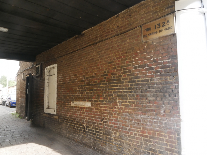
5018 BENNETS YARD
(off Uxbridge High Street)
Wall along south-east
side of alley
TQ 0584 SW 18/278
TQ 0584 SE 19/278
II
2.
C17 or earlier tall red brick wall with flat buttresses and plinth. Some upper
courses renewed.
Listing NGR: TQ0547484271
External links are from the relevant listing authority and, where applicable, Wikidata. Wikidata IDs may be related buildings as well as this specific building. If you want to add or update a link, you will need to do so by editing the Wikidata entry.


Other nearby listed buildings
