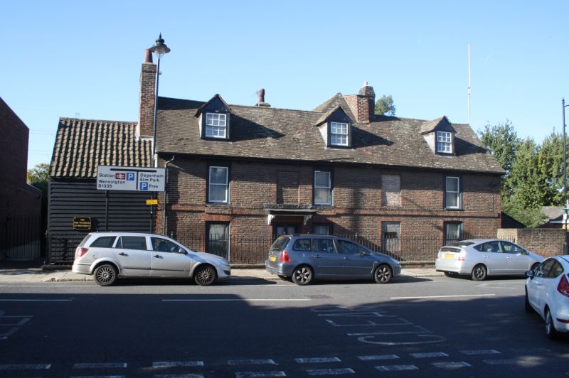
Latitude: 51.5184 / 51°31'6"N
Longitude: 0.1899 / 0°11'23"E
OS Eastings: 552041
OS Northings: 182214
OS Grid: TQ520822
Mapcode National: GBR SP.4JP
Mapcode Global: VHHNM.73SB
Plus Code: 9F32G59Q+9X
Entry Name: The Vicarage
Listing Date: 7 January 1955
Grade: II
Source: Historic England
Source ID: 1358507
English Heritage Legacy ID: 201555
ID on this website: 101358507
Location: Rainham, Havering, London, RM13
County: London
District: Havering
Electoral Ward/Division: Rainham and Wennington
Parish: Non Civil Parish
Built-Up Area: Havering
Traditional County: Essex
Lieutenancy Area (Ceremonial County): Greater London
Church of England Parish: Rainham
Church of England Diocese: Chelmsford
Tagged with: Clergy house
BROADWAY 1. 5017 Rainham The Vicarage TQ 5282/5382 6/4 7.1.55 II GV 2. 1710 (article by H F Biden in the Upper Norwood Athenaeum 1913). Two storeys and attic. Three sashes, no glazing bars, and 3 blank panels. Door off-centre with wide hood on bold shaped brackets. Modern tiled roof. Three gabled sash dormers. Gable ends. Plain stacks. Later wing to the rear with roof-ridge rising above that of the main range. Two storey weatherboarded extension at south-east with lower roof line, pantiled.
Listing NGR: TQ5204182214
External links are from the relevant listing authority and, where applicable, Wikidata. Wikidata IDs may be related buildings as well as this specific building. If you want to add or update a link, you will need to do so by editing the Wikidata entry.


Other nearby listed buildings