Latitude: 51.6112 / 51°36'40"N
Longitude: -0.2802 / 0°16'48"W
OS Eastings: 519180
OS Northings: 191662
OS Grid: TQ191916
Mapcode National: GBR 8K.01X
Mapcode Global: VHGQB.3R6Q
Plus Code: 9C3XJP69+FW
Entry Name: 97, High Street
Listing Date: 9 July 1968
Grade: II
Source: Historic England
Source ID: 1358607
English Heritage Legacy ID: 202064
ID on this website: 101358607
Location: Canons Park, Harrow, London, HA8
County: London
District: Harrow
Electoral Ward/Division: Canons
Parish: Non Civil Parish
Built-Up Area: Harrow
Traditional County: Middlesex
Lieutenancy Area (Ceremonial County): Greater London
Church of England Parish: St Lawrence Whitchurch Lane
Church of England Diocese: London
Tagged with: Building
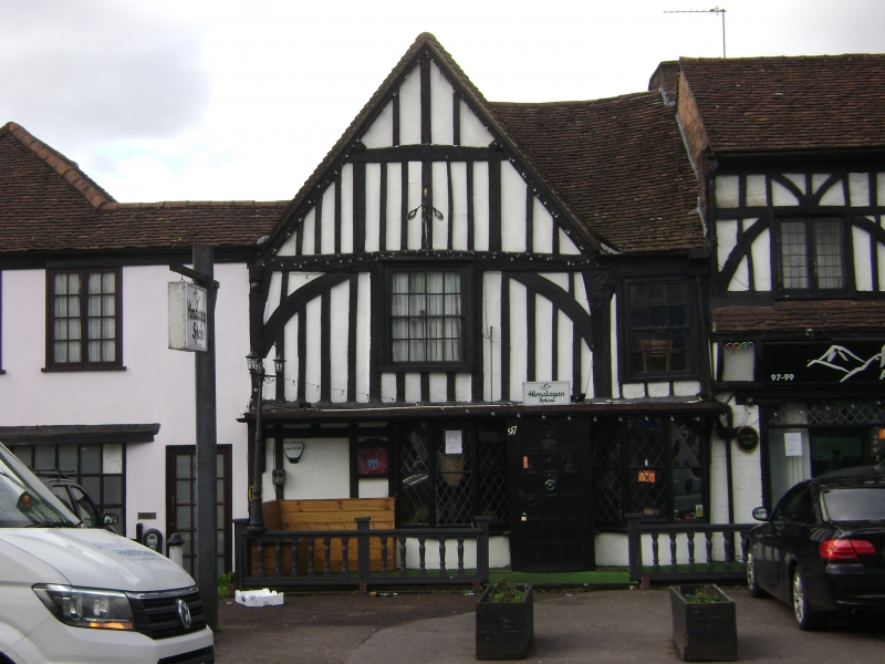
HIGH STREET
1.
5016
Edgware
No 97
TQ 1991 9/3 9.7.68
II GV
2.
Small C16, timbered, gabled house with first floor overhang. C18. Upper windows,
C19 shop window with leaded lights.
Listing NGR: TQ1918091662
External links are from the relevant listing authority and, where applicable, Wikidata. Wikidata IDs may be related buildings as well as this specific building. If you want to add or update a link, you will need to do so by editing the Wikidata entry.


Other nearby listed buildings