Approximate Location Map
Large Map »
Latitude: 51.6213 / 51°37'16"N
Longitude: -0.3174 / 0°19'2"W
OS Eastings: 516576
OS Northings: 192725
OS Grid: TQ165927
Mapcode National: GBR 6V.GNC
Mapcode Global: VHGQ9.GH1Z
Plus Code: 9C3XJMCM+G2
Entry Name: 115, Stanmore Hill
Listing Date: 6 April 1981
Grade: II
Source: Historic England
Source ID: 1358644
English Heritage Legacy ID: 202167
ID on this website: 101358644
Location: Stanmore, Harrow, London, HA7
County: London
District: Harrow
Electoral Ward/Division: Stanmore Park
Parish: Non Civil Parish
Built-Up Area: Harrow
Traditional County: Middlesex
Lieutenancy Area (Ceremonial County): Greater London
Church of England Parish: St John the Evangelist Great Stanmore
Church of England Diocese: London
Tagged with: Building
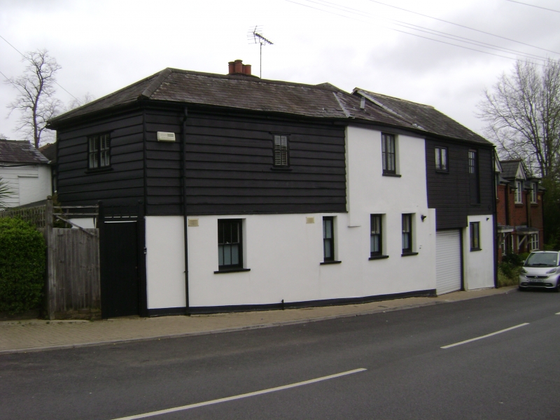
STANMORE HILL
1.
50l6
(west side)
Stanmore
No 115
TQ 1692 NE 7/1 6.4.81
II GV
2.
Part of a prominently sited group of C18 and C19 two-storey buildings of brick with
white painted weatherboarding. Slate and tile roofs. Various windows including
sashes, casements and Gothic-arched. Included for group value.
Listing NGR: TQ1657692725
External links are from the relevant listing authority and, where applicable, Wikidata. Wikidata IDs may be related buildings as well as this specific building. If you want to add or update a link, you will need to do so by editing the Wikidata entry.


Other nearby listed buildings
