Approximate Location Map
Large Map »
Latitude: 51.3746 / 51°22'28"N
Longitude: -0.0709 / 0°4'15"W
OS Eastings: 534364
OS Northings: 165714
OS Grid: TQ343657
Mapcode National: GBR HR.4T4
Mapcode Global: VHGRL.QQC3
Plus Code: 9C3X9WFH+RJ
Entry Name: Addiscombe Farm Cottage
Listing Date: 13 June 1979
Grade: II
Source: Historic England
Source ID: 1358825
English Heritage Legacy ID: 201152
ID on this website: 101358825
Location: Addiscombe, Croydon, London, CR0
County: London
District: Croydon
Electoral Ward/Division: Ashburton
Parish: Non Civil Parish
Built-Up Area: Croydon
Traditional County: Surrey
Lieutenancy Area (Ceremonial County): Greater London
Church of England Parish: Addiscombe St Mildred
Church of England Diocese: Southwark
Tagged with: Cottage
1.
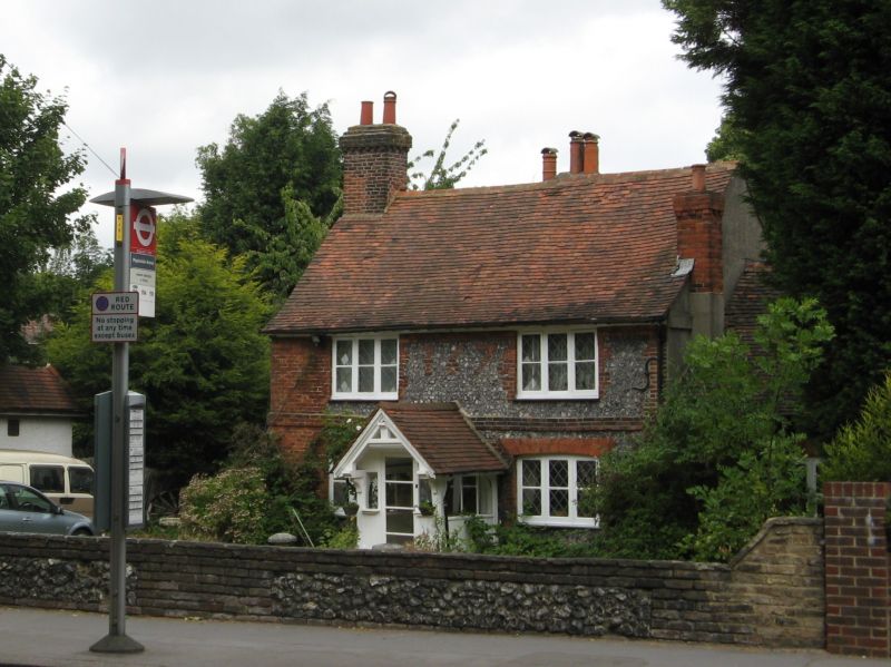
5009 ADDISCOMBE ROAD
No 281
(Addiscombe Farm Cottage)
TQ 36 NW 2/36 13.6.79
II
2.
Dated 1676 in bricks on front. Flint and brick faced cottage. Two storeys. Brick
band between storeys. Two wide C19 casements. Modern central porch. Tile roof.
Single storey addition on right.
Listing NGR: TQ3436465714
External links are from the relevant listing authority and, where applicable, Wikidata. Wikidata IDs may be related buildings as well as this specific building. If you want to add or update a link, you will need to do so by editing the Wikidata entry.


Other nearby listed buildings
