Latitude: 51.5113 / 51°30'40"N
Longitude: -0.1059 / 0°6'21"W
OS Eastings: 531535
OS Northings: 180856
OS Grid: TQ315808
Mapcode National: GBR ND.CD
Mapcode Global: VHGR0.38VR
Plus Code: 9C3XGV6V+GJ
Entry Name: Main block of City of London School (Main front block only)
Listing Date: 4 March 1969
Grade: II
Source: Historic England
Source ID: 1358920
English Heritage Legacy ID: 199799
ID on this website: 101358920
Location: Holborn, City of London, London, EC4V
County: London
District: City and County of the City of London
Electoral Ward/Division: Castle Baynard
Parish: Non Civil Parish
Built-Up Area: City of London
Traditional County: Middlesex
Lieutenancy Area (Ceremonial County): City of London
Church of England Parish: St Bride Fleet Street
Church of England Diocese: London
Tagged with: Architectural structure Former school building
This list entry was subject to a Minor Amendment on 13 June 2025 to correct a typo in the description and to reformat the text to current standards
TQ 3180 NE
14/387
VICTORIA EMBANKMENT EC4
Main block of City of London School (Main front block only)
4.3.69.
II
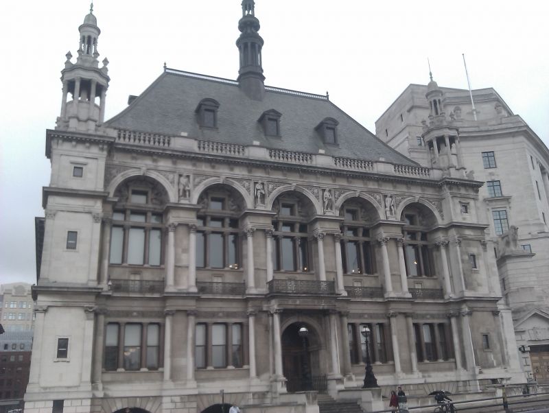
1881-1882, by Davis and Emanuel. Large scale, richly modelled Portland stone building in northern renaissance manner. Two main storeys above basement. Dormers in hipped, slated roof. Ionic order to ground storey, Corinthian order above supporting arches with lunette windows. Corner pavilions with cupolas. Central lantern to roof.
Short return to west: plain, eastern return now exposed. Two lamp standards to front area parapet. Irregular buildings at rear of no interest.
Interior contains entrance staircase of marble with colonnade, and great hall occupying whole of upper part of main block.
Listing NGR: TQ3153580856
External links are from the relevant listing authority and, where applicable, Wikidata. Wikidata IDs may be related buildings as well as this specific building. If you want to add or update a link, you will need to do so by editing the Wikidata entry.


Other nearby listed buildings