Latitude: 51.6315 / 51°37'53"N
Longitude: -0.1234 / 0°7'24"W
OS Eastings: 529977
OS Northings: 194188
OS Grid: TQ299941
Mapcode National: GBR FJ.X49
Mapcode Global: VHGQD.T834
Plus Code: 9C3XJVJG+HJ
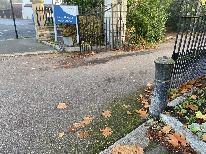
Entry Name: Pair of Gun Posts Outside Gate to Grovelands Park Hospital at Junction of the Bourne and Queen Elizabeth Drive
Listing Date: 31 January 1974
Grade: II
Source: Historic England
Source ID: 1358980
English Heritage Legacy ID: 200522
ID on this website: 101358980
Location: Southgate, Enfield, London, N14
County: London
District: Enfield
Electoral Ward/Division: Southgate
Parish: Non Civil Parish
Built-Up Area: Enfield
Traditional County: Middlesex
Lieutenancy Area (Ceremonial County): Greater London
Church of England Parish: St Paul Winchmore Hill
Church of England Diocese: London
Tagged with: Architectural structure
1. 4411 THE BOURNE N14 (North Side) (Off) Pair of Gun Posts outside gate to Grovelands Park Hospital at junction of The Bourne and Queen Elizabeth Drive. TQ 29 SE 22/12
II
2. Early C19 cast gun posts.
Listing NGR: TQ2997794188
External links are from the relevant listing authority and, where applicable, Wikidata. Wikidata IDs may be related buildings as well as this specific building. If you want to add or update a link, you will need to do so by editing the Wikidata entry.


Other nearby listed buildings