Approximate Location Map
Large Map »
Latitude: 51.5133 / 51°30'47"N
Longitude: -0.1026 / 0°6'9"W
OS Eastings: 531762
OS Northings: 181078
OS Grid: TQ317810
Mapcode National: GBR PC.3Q
Mapcode Global: VHGR0.57M8
Plus Code: 9C3XGV7W+8X
Entry Name: 79, Carter Lane EC4
Listing Date: 5 June 1972
Grade: II
Source: Historic England
Source ID: 1359137
English Heritage Legacy ID: 199355
ID on this website: 101359137
Location: City of London, London, EC4V
County: London
District: City and County of the City of London
Electoral Ward/Division: Farringdon Within
Parish: Non Civil Parish
Built-Up Area: City of London
Traditional County: Middlesex
Lieutenancy Area (Ceremonial County): City of London
Church of England Parish: St Andrew-by-the-Wardrobe
Church of England Diocese: London
Tagged with: Building
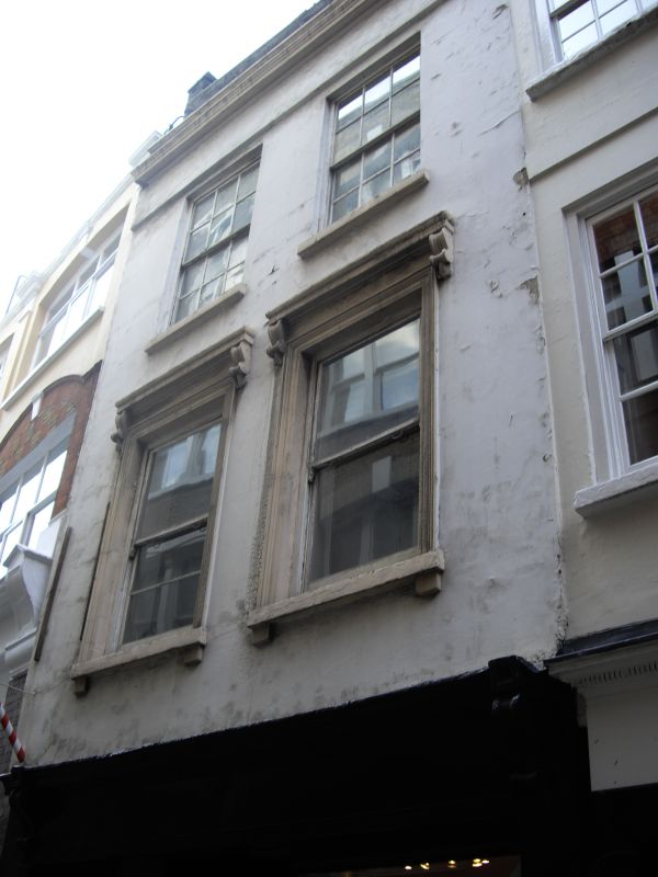
CARTER LANE EC4
1.
5002
(South Side)
No 79
TQ 3181 SE 8/195 5.6.72.
II GV
2.
Possibly late C17, stuccoed in C19. 3 storeys plus continuous dormer. 2 windows.
Shop. Corniced 1st floor windows. Crowning cornice and parapet.
Listing NGR: TQ3176281078
External links are from the relevant listing authority and, where applicable, Wikidata. Wikidata IDs may be related buildings as well as this specific building. If you want to add or update a link, you will need to do so by editing the Wikidata entry.


Other nearby listed buildings
