Approximate Location Map
Large Map »
Latitude: 51.3506 / 51°21'2"N
Longitude: 0.1179 / 0°7'4"E
OS Eastings: 547579
OS Northings: 163410
OS Grid: TQ475634
Mapcode National: GBR QH.QCM
Mapcode Global: VHHPC.095Z
Plus Code: 9F329429+64
Entry Name: Julian's Brimstone
Listing Date: 29 June 1973
Grade: II
Source: Historic England
Source ID: 1359645
English Heritage Legacy ID: 358389
ID on this website: 101359645
Location: Bromley, London, BR6
County: London
District: Bromley
Electoral Ward/Division: Chelsfield and Pratts Bottom
Parish: Non Civil Parish
Built-Up Area: Bromley
Traditional County: Kent
Lieutenancy Area (Ceremonial County): Greater London
Church of England Parish: Chelsfield St Martin of Tours
Church of England Diocese: Rochester
Tagged with: Architectural structure
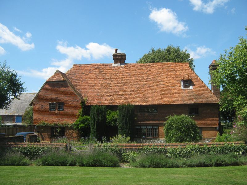
CHURCH ROAD, CHELSFIELD
1.
4407 (North-West Side)
Julian's Brimstone
TQ 46 SE 10/135
II
2.
Cl7 or earlier farmhouse refaced with red brick on ground floor and tile
hung above. 2 storeys. 3 windows. Tiled roof casement windows. Half-
hipped gable at the West end of the front.
Listing NGR: TQ4757963410
External links are from the relevant listing authority and, where applicable, Wikidata. Wikidata IDs may be related buildings as well as this specific building. If you want to add or update a link, you will need to do so by editing the Wikidata entry.


Other nearby listed buildings
