Approximate Location Map
Large Map »
Latitude: 53.3671 / 53°22'1"N
Longitude: -0.0053 / 0°0'19"W
OS Eastings: 532817
OS Northings: 387440
OS Grid: TF328874
Mapcode National: GBR XYDH.MP
Mapcode Global: WHHJS.WMMJ
Plus Code: 9C5X9X8V+VV
Entry Name: 35-39, Eastgate
Listing Date: 18 February 1974
Grade: II
Source: Historic England
Source ID: 1359882
English Heritage Legacy ID: 194938
ID on this website: 101359882
Location: Louth, East Lindsey, Lincolnshire, LN11
County: Lincolnshire
District: East Lindsey
Civil Parish: Louth
Built-Up Area: Louth
Traditional County: Lincolnshire
Lieutenancy Area (Ceremonial County): Lincolnshire
Church of England Parish: Louth
Church of England Diocese: Lincoln
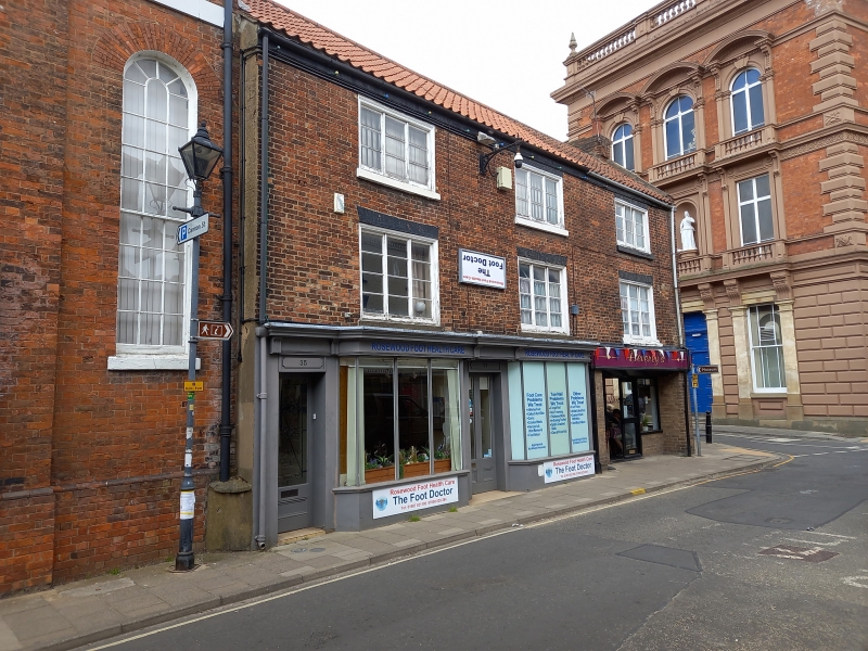
EASTGATE
1.
1348
(North Side)
Nos 35 to 39 (odd)
TF 38 NW 1/163
II GV
2.
Early C19. 3 storeys in brick. Pantile roof. Band at eaves. 3 windows, brick
arches, 3-light casements. 2 C19 shop fronts and one modern shop front.
Nos 33 to 39 (odd), Louth Centenary Methodist Church & Town Hall together with
Nos 2 & 4 Nichol Hill form a group.
Listing NGR: TF3281487441
External links are from the relevant listing authority and, where applicable, Wikidata. Wikidata IDs may be related buildings as well as this specific building. If you want to add or update a link, you will need to do so by editing the Wikidata entry.


Other nearby listed buildings
