Latitude: 52.4368 / 52°26'12"N
Longitude: -1.2085 / 1°12'30"W
OS Eastings: 453901
OS Northings: 282387
OS Grid: SP539823
Mapcode National: GBR 8PW.78V
Mapcode Global: VHCTL.00GR
Plus Code: 9C4WCQPR+PH
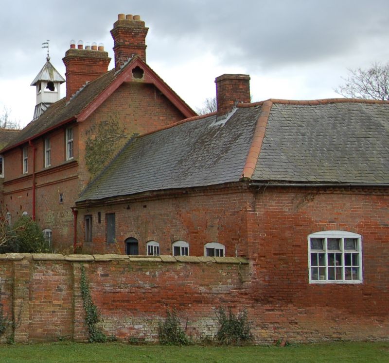
Entry Name: Stable Range Adjoining North West of Cotesbach Hall
Listing Date: 5 June 1992
Grade: II
Source: Historic England
Source ID: 1360767
English Heritage Legacy ID: 191412
ID on this website: 101360767
Location: Cotesbach, Harborough, Leicestershire, LE17
County: Leicestershire
District: Harborough
Civil Parish: Cotesbach
Traditional County: Leicestershire
Lieutenancy Area (Ceremonial County): Leicestershire
Church of England Parish: Cotesbach St Mary
Church of England Diocese: Leicester
Tagged with: Stable
SP 58 SW COTESBACH MAIN STREET (south side)
3/92 Stable range adjoining NW of Cotesbach Hall
GV II
Stable range. C18. Flemish bond red brick. Welsh slate roof with gabled ends and cogged brick eaves cornice. PLAN; L-shaped plan, the short east wing attached to service wing of Cotesbsch Hall (q.v.). Back onto road and faces yard. EXTERIOR: one storey and loft. South front is asymmetrical and has 2 two-light casements with glazing bars to right. Doorways between and to left with large rectangular overlights. Wing to right has two 2-light horizantally sliding sashes with glazing bars and 2 plank doors, one with overlight. All openings have cambered brick arches. Small pedimented dormer over right-hand end of main range and hipped dormer over wing. Main range has small louvred lantern and weathervane on ridge. At rear (N) cambered arch window on left and small loft hatch to left of centre. Lean-to outshut on west end with 2-light loft window in gable above.
Listing NGR: SP5390182387
External links are from the relevant listing authority and, where applicable, Wikidata. Wikidata IDs may be related buildings as well as this specific building. If you want to add or update a link, you will need to do so by editing the Wikidata entry.


Other nearby listed buildings