Approximate Location Map
Large Map »
Latitude: 52.871 / 52°52'15"N
Longitude: -0.777 / 0°46'37"W
OS Eastings: 482415
OS Northings: 331088
OS Grid: SK824310
Mapcode National: GBR CP0.VSH
Mapcode Global: WHFJP.138C
Plus Code: 9C4XV6CF+95
Entry Name: Monument 15 Metres South of Tower of Church of All Saints
Listing Date: 22 March 1991
Grade: II
Source: Historic England
Source ID: 1360892
English Heritage Legacy ID: 190015
ID on this website: 101360892
Location: All Saints' Church, Knipton, Melton, Leicestershire, NG32
County: Leicestershire
District: Melton
Civil Parish: Belvoir
Traditional County: Leicestershire
Lieutenancy Area (Ceremonial County): Leicestershire
Church of England Parish: Knipton (High Framland Parishes)
Church of England Diocese: Leicester
Tagged with: Monument
SK 8231-8331 BELVOIR CHURCH HILL
(South end)
Knipton
44/450 Monument 15 m south
of tower of Church
of All Saints
GV
II
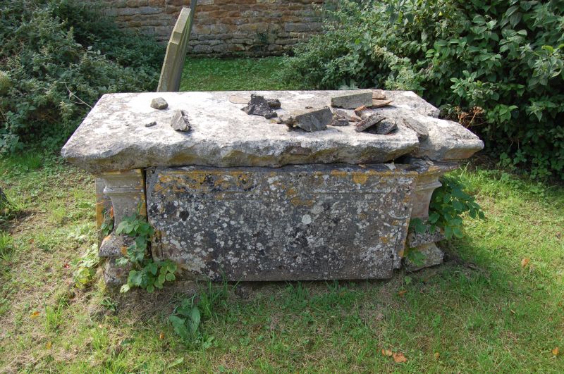
Table tomb. Mid C18. Illegible inscriptions. Limestone. 4 incised slabs
with corner balusters. Flat top slab with ogival moulded edge.
Listing NGR: SK8241531088
External links are from the relevant listing authority and, where applicable, Wikidata. Wikidata IDs may be related buildings as well as this specific building. If you want to add or update a link, you will need to do so by editing the Wikidata entry.


Other nearby listed buildings
