Approximate Location Map
Large Map »
Latitude: 52.805 / 52°48'18"N
Longitude: -1.1061 / 1°6'21"W
OS Eastings: 460358
OS Northings: 323428
OS Grid: SK603234
Mapcode National: GBR 9LW.367
Mapcode Global: WHDHK.ZRGG
Plus Code: 9C4WRV4V+2H
Entry Name: 17, Church Street
Listing Date: 15 March 1984
Grade: II
Source: Historic England
Source ID: 1361150
English Heritage Legacy ID: 189343
ID on this website: 101361150
Location: Wymeswold, Charnwood, Leicestershire, LE12
County: Leicestershire
District: Charnwood
Civil Parish: Wymeswold
Built-Up Area: Wymeswold
Traditional County: Leicestershire
Lieutenancy Area (Ceremonial County): Leicestershire
Church of England Parish: Wymeswold St Mary
Church of England Diocese: Leicester
Tagged with: Building
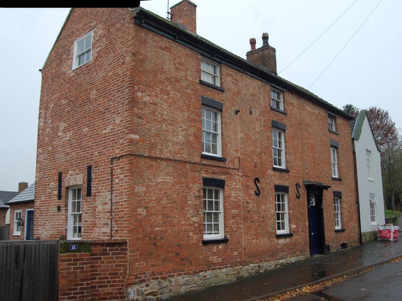
SK 6023 - 6123 WYMESWOLD CHURCH STREET
(West side)
2/85 No. 17
GV II
House, late.C18. Brickwork with rendered gable and new roof covering.
3 storeys, but top storey is a later heightening. 4 bays with doorway
off centre. Slightly cambered heads to sash windows. 2 axial stacks.
Listing NGR: SK6035823428
External links are from the relevant listing authority and, where applicable, Wikidata. Wikidata IDs may be related buildings as well as this specific building. If you want to add or update a link, you will need to do so by editing the Wikidata entry.


Other nearby listed buildings
