Approximate Location Map
Large Map »
Latitude: 53.4221 / 53°25'19"N
Longitude: -3.003 / 3°0'10"W
OS Eastings: 333442
OS Northings: 392167
OS Grid: SJ334921
Mapcode National: GBR 70H.D8
Mapcode Global: WH876.V75W
Plus Code: 9C5RCXCW+RR
Entry Name: Dock Retaining Wall at Salisbury Dock
Listing Date: 14 March 1975
Grade: II
Source: Historic England
Source ID: 1361686
English Heritage Legacy ID: 359438
ID on this website: 101361686
Location: Vauxhall, Liverpool, Merseyside, L3
County: Liverpool
Electoral Ward/Division: Kirkdale
Parish: Non Civil Parish
Built-Up Area: Liverpool
Traditional County: Lancashire
Lieutenancy Area (Ceremonial County): Merseyside
Church of England Parish: Liverpool Our Lady and St Nicholas
Church of England Diocese: Liverpool
Tagged with: Architectural structure
SJ 3392
27/1083
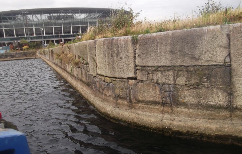
SALISBURY DOCK, L3
Dock Retaining Wall
14.3.75.
G.V. II
Dock retaining wall. 1848. J. Hartley. Granite rubble brought to a fair face, of large and small blocks. Entrances to Trafalgar, Collingwood and Nelson Docks.
Listing NGR: SJ3344292166
External links are from the relevant listing authority and, where applicable, Wikidata. Wikidata IDs may be related buildings as well as this specific building. If you want to add or update a link, you will need to do so by editing the Wikidata entry.


Other nearby listed buildings
