Latitude: 53.8536 / 53°51'12"N
Longitude: -2.2102 / 2°12'36"W
OS Eastings: 386268
OS Northings: 439723
OS Grid: SD862397
Mapcode National: GBR FR0W.9B
Mapcode Global: WHB7R.0DSN
Plus Code: 9C5VVQ3Q+CW
Entry Name: Cruck Barn at Pendle Heritage Centre
Listing Date: 24 January 1978
Last Amended: 2 September 1991
Grade: II
Source: Historic England
Source ID: 1361730
English Heritage Legacy ID: 186437
ID on this website: 101361730
Location: Barrowford, Pendle, Lancashire, BB9
County: Lancashire
District: Pendle
Civil Parish: Barrowford
Built-Up Area: Barrowford
Traditional County: Lancashire
Lieutenancy Area (Ceremonial County): Lancashire
Church of England Parish: Barrowford St Thomas
Church of England Diocese: Blackburn
Tagged with: Barn
SD 8639 NW BARROWFORD PARK HILL
16/302 Cruck Barn at Pendle Heritage Centre
24.1.78 II
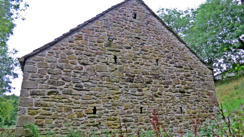
Former grain and threshing barn. Late C16 with C20 stone cladding. The barn was originally listed as 'barn to west of White House Farmhouse, Cliviger, Burnley, Lancashire' and was dismantled, and re-erected on the present site 1990-1. Initially entirely timber framed; 4 bays, 3 full-cruck trusses (end crucks lost when stone cladding added in c17 or C18); all have collars and yokes; associated wall posts pegged into ties and feet of blades; fragmentary survival of wall plates and side purlins. Re- used stone cladding with some detailing brought from elsewhere.
The above building was originally listed under the parish of Cliviger in the Borough of Burnley. Now moved to the parish of Barrowford in the District of Pendle.
External links are from the relevant listing authority and, where applicable, Wikidata. Wikidata IDs may be related buildings as well as this specific building. If you want to add or update a link, you will need to do so by editing the Wikidata entry.


Other nearby listed buildings