Latitude: 52.6716 / 52°40'17"N
Longitude: -0.7305 / 0°43'49"W
OS Eastings: 485935
OS Northings: 308971
OS Grid: SK859089
Mapcode National: GBR CRL.G3W
Mapcode Global: WHFKN.R39P
Plus Code: 9C4XM7C9+MQ
Entry Name: 17, Northgate
Listing Date: 8 May 1950
Grade: II
Source: Historic England
Source ID: 1361773
English Heritage Legacy ID: 186539
ID on this website: 101361773
Location: Oakham, Rutland, LE15
County: Rutland
Civil Parish: Oakham
Built-Up Area: Oakham
Traditional County: Rutland
Lieutenancy Area (Ceremonial County): Rutland
Church of England Parish: Oakham All Saints
Church of England Diocese: Peterborough
Tagged with: Building
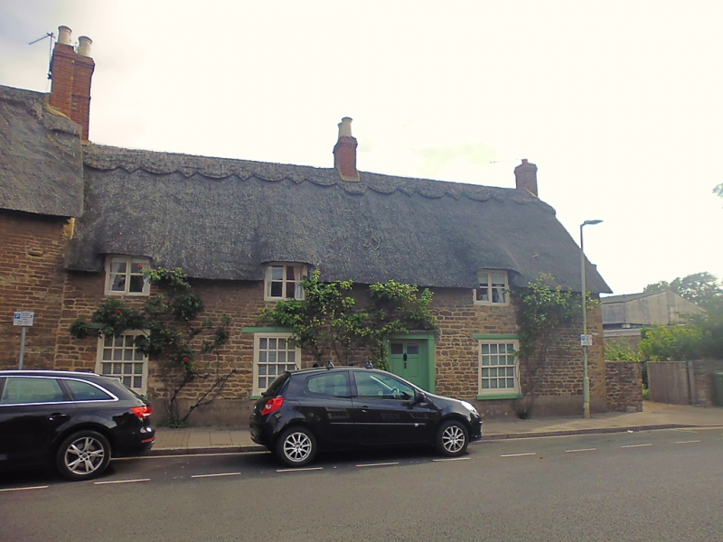
1. NORTHGATE
1469
(North Side)
No 17
SK 8508 6/91 8.5.50.
II GV
2.
Mid C17 house. 1-storey and attics. Coursed rubble. Reed thatch. 3 windows
with wood casements; ground floor windows have hung sashes and carved wood
lintels. 6-panel door in early C19 reeded wood doorcase with small hood.
Nos 17 to 27 (odd) form a group.
Listing NGR: SK8593508971
External links are from the relevant listing authority and, where applicable, Wikidata. Wikidata IDs may be related buildings as well as this specific building. If you want to add or update a link, you will need to do so by editing the Wikidata entry.


Other nearby listed buildings