Approximate Location Map
Large Map »
Latitude: 53.6042 / 53°36'14"N
Longitude: -2.7055 / 2°42'19"W
OS Eastings: 353416
OS Northings: 412186
OS Grid: SD534121
Mapcode National: GBR 9VKR.2R
Mapcode Global: WH86D.DNXV
Plus Code: 9C5VJ73V+MR
Entry Name: South Tunley Hall Farmhouse
Listing Date: 19 November 1951
Grade: II
Source: Historic England
Source ID: 1361888
English Heritage Legacy ID: 357886
ID on this website: 101361888
Location: Mossy Lea, West Lancashire, WN6
County: Lancashire
District: West Lancashire
Civil Parish: Wrightington
Traditional County: Lancashire
Lieutenancy Area (Ceremonial County): Lancashire
Church of England Parish: Wrightington with Heskin St James the Great
Church of England Diocese: Blackburn
Tagged with: Farmhouse
WRIGHTINGTON OLD WASH LANE (north side)
SD 51 SW
5/108 South Tunley Hall Farmhouse
19-11-1951
II
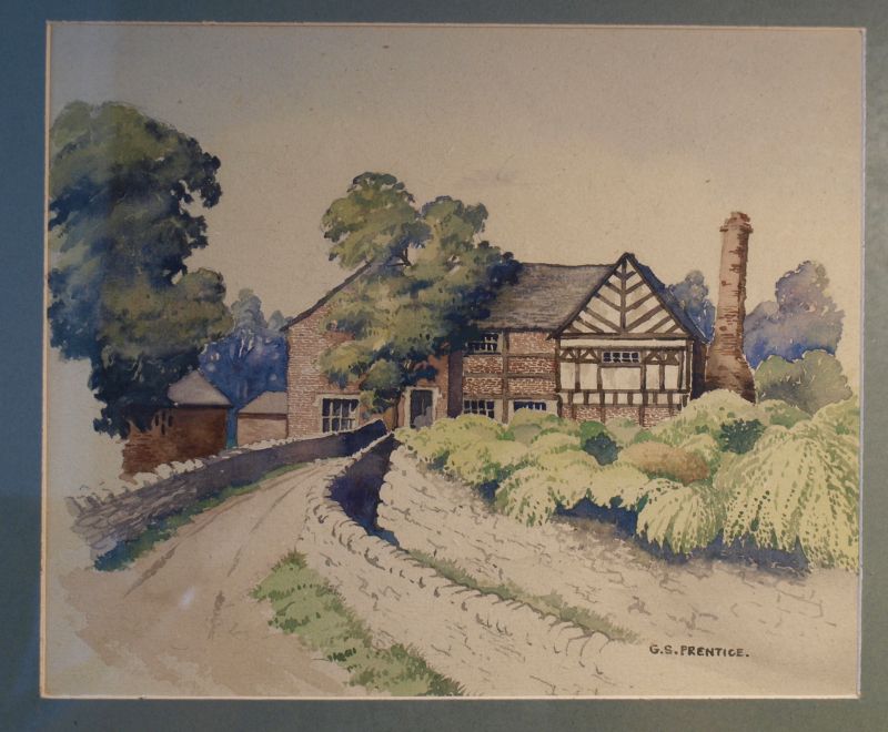
House. C17. Brick with sandstone plinth and quoins and slate roof.
Comprises the west cross-wing and rebuilt hall range of an H-plan house
partly demolished in 1958. 2 storeys with attic. Windows are C20
casements with plastered surrounds. South gable of cross-wing of one bay
with blocked attic window, and blocked stair window with label to right
on 1st floor. To the right is a lead rainwater pipe with cast lions'
heads at the joints and with a hopper inscribed: 'TWE 1667'. This is a
possible date for this wing. The main range is of 2 bays. In the left-
hand bay is a single-storey lean-to porch of sandstone which has a
chamfered doorway with canted head. The lintel is inscribed:'TW MW 1622'.
The inner plank door has strap hinges and a moulded timber surround with
canted head. Chimney on ridge of wing. An illustration of the house
before alterations shows a 2-storey hall range with square-panelled
timber-framing on the 1st floor, a 2-storey porch with plastered upper
storey, and a timber-framed east wing with fishbone king post: all could
be early C17. VCH Vol.3, facing p 180.
Listing NGR: SD5341612186
External links are from the relevant listing authority and, where applicable, Wikidata. Wikidata IDs may be related buildings as well as this specific building. If you want to add or update a link, you will need to do so by editing the Wikidata entry.


Other nearby listed buildings
