Approximate Location Map
Large Map »
Latitude: 53.8789 / 53°52'44"N
Longitude: -2.7899 / 2°47'23"W
OS Eastings: 348168
OS Northings: 442815
OS Grid: SD481428
Mapcode National: GBR 8RYL.S8
Mapcode Global: WH850.3RRQ
Plus Code: 9C5VV6H6+H2
Entry Name: Headstone North of Church of St Helen
Listing Date: 9 January 1986
Grade: II
Source: Historic England
Source ID: 1361958
English Heritage Legacy ID: 185536
ID on this website: 101361958
Location: St Helen's Church, Churchtown, Wyre, Lancashire, PR3
County: Lancashire
District: Wyre
Civil Parish: Kirkland
Traditional County: Lancashire
Lieutenancy Area (Ceremonial County): Lancashire
Church of England Parish: Garstang St Helen, Churchtown
Church of England Diocese: Blackburn
Tagged with: Tombstone
KIRKLAND CHURCHTOWN
SD 44 SE
7/142
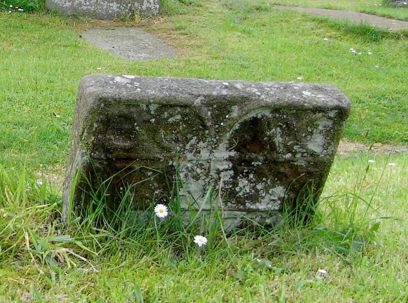
Headstone north of Church of St Helen
GV
II
Headstone, 1727/28 , sandstone. Inscribed: 'BC 1728' at left, and 'AC
1727' at right.
Listing NGR: SD4816842815
External links are from the relevant listing authority and, where applicable, Wikidata. Wikidata IDs may be related buildings as well as this specific building. If you want to add or update a link, you will need to do so by editing the Wikidata entry.


Other nearby listed buildings
