Approximate Location Map
Large Map »
Latitude: 53.8525 / 53°51'8"N
Longitude: -2.7452 / 2°44'42"W
OS Eastings: 351077
OS Northings: 439838
OS Grid: SD510398
Mapcode National: GBR 9R8W.GR
Mapcode Global: WH856.SFYH
Plus Code: 9C5VV723+XW
Entry Name: Milestone
Listing Date: 9 January 1986
Grade: II
Source: Historic England
Source ID: 1361960
English Heritage Legacy ID: 185546
ID on this website: 101361960
Location: Bilsborrow, Wyre, Lancashire, PR3
County: Lancashire
District: Wyre
Civil Parish: Myerscough and Bilsborrow
Built-Up Area: Bilsborrow
Traditional County: Lancashire
Lieutenancy Area (Ceremonial County): Lancashire
Church of England Parish: Bilsborrow St Hilda
Church of England Diocese: Blackburn
Tagged with: Milestone
MYERSCOUGH A6
SD 53 NW
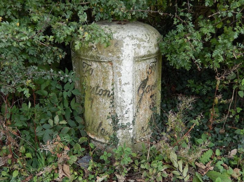
11/152 Milestone
-
- II
Milestone, late C18. Sandstone with iron plates. Half-oval on plan.
Left-hand plate inscribed: 'To Preston 7 Miles'. Right-hand plate
inscribed: 'To Garstang 3 3/4 Miles'.
Listing NGR: SD5107739838
External links are from the relevant listing authority and, where applicable, Wikidata. Wikidata IDs may be related buildings as well as this specific building. If you want to add or update a link, you will need to do so by editing the Wikidata entry.


Other nearby listed buildings
