Latitude: 53.6968 / 53°41'48"N
Longitude: -2.2969 / 2°17'48"W
OS Eastings: 380491
OS Northings: 422306
OS Grid: SD804223
Mapcode National: GBR DTDP.JJ
Mapcode Global: WH97B.PBFS
Plus Code: 9C5VMPW3+P6
Entry Name: Chimney c20 metres East of Former Hardman's Mill
Listing Date: 7 June 1971
Last Amended: 30 November 1984
Grade: II
Source: Historic England
Source ID: 1361986
English Heritage Legacy ID: 185802
ID on this website: 101361986
Location: New Hall Hey, Rossendale, Lancashire, BB4
County: Lancashire
District: Rossendale
Electoral Ward/Division: Longholme
Parish: Non Civil Parish
Built-Up Area: Rawtenstall
Traditional County: Lancashire
Lieutenancy Area (Ceremonial County): Lancashire
Church of England Parish: Rawtenstall St Mary
Church of England Diocese: Manchester
Tagged with: Chimney
This list entry was subject to a Minor Amendment on 3 June 2025 to update the Name and Address and reformat the text to current standards
SD 82 SW
6/223
RAWTENSTALL
NEW HALL HEY ROAD
Hardmans Business Centre
Chimney c20 metres East of Former Hardman's Mill
(Formerly listed as NEW HALL HEY Chimney c.20 metres north of Hardman's Mill (formerly listed by inclusion with "Whitehead's Mill"))
7.6.1971
GV
II
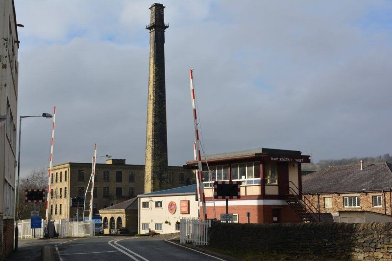
Chimney, later C19. Dressed sandstone. Square section. Very tall and slender structure: cubical plinth with moulded weathering to the top, tall chimney with chamfered corners, lancet-like openings or niches on three levels, square platform with iron railings at top level, and flue cap with Lombard frieze to cornice.
Listing NGR: SD8049122306
External links are from the relevant listing authority and, where applicable, Wikidata. Wikidata IDs may be related buildings as well as this specific building. If you want to add or update a link, you will need to do so by editing the Wikidata entry.


Other nearby listed buildings