Latitude: 53.6313 / 53°37'52"N
Longitude: -2.625 / 2°37'30"W
OS Eastings: 358765
OS Northings: 415153
OS Grid: SD587151
Mapcode National: GBR BV3G.H0
Mapcode Global: WH97C.NZ6L
Plus Code: 9C5VJ9JF+GX
Entry Name: Duxbury Hall Coachhouse
Listing Date: 21 December 1966
Last Amended: 21 February 1984
Grade: II
Source: Historic England
Source ID: 1362041
English Heritage Legacy ID: 357559
ID on this website: 101362041
Location: Heath Charnock, Chorley, Lancashire, PR7
County: Lancashire
District: Chorley
Electoral Ward/Division: Chorley South East
Parish: Non Civil Parish
Traditional County: Lancashire
Lieutenancy Area (Ceremonial County): Lancashire
Church of England Parish: Adlington St Paul
Church of England Diocese: Blackburn
Tagged with: Architectural structure
SD 51 NE CHORLEY DUXBURY PARK
5/44 Duxbury Hall Coachhouse 21.12.1966 (Formerly listed as Coach-house under Duxbury Hall)
GV II
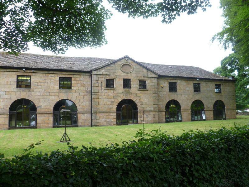
Coachhouse, probably earlier C18. Ashlar front, other walls of brick (left end) and rubble; hipped roof of concrete tiles with small brick chimney forward of the centre. Rectangular plan of 7 bays and 2 storeys. Symmetrical; pedimented centre bay breaks forward,has rusticated quoins, a wide round-headed arch with rusticated voussoirs (now blocked with brick), 3 square 1st floor window openings, and a moulded oeil-de-boeuf. The form of the 3 openings on each floor to left and right matches the centre, but the ground floor arches are lunettes (blocked) linked by an impost band which carries across the openings as a sill. Rusticated quoins continue above the eaves as short chimneys.
External links are from the relevant listing authority and, where applicable, Wikidata. Wikidata IDs may be related buildings as well as this specific building. If you want to add or update a link, you will need to do so by editing the Wikidata entry.


Other nearby listed buildings