Latitude: 51.2591 / 51°15'32"N
Longitude: 0.2947 / 0°17'40"E
OS Eastings: 560209
OS Northings: 153610
OS Grid: TQ602536
Mapcode National: GBR MN8.WXB
Mapcode Global: VHHPV.2M43
Plus Code: 9F32775V+MV
Entry Name: Church House the Old Post Office
Listing Date: 3 May 1984
Grade: II
Source: Historic England
Source ID: 1362059
English Heritage Legacy ID: 357331
ID on this website: 101362059
Location: Yopps Green, Tonbridge and Malling, Kent, TN15
County: Kent
District: Tonbridge and Malling
Civil Parish: Plaxtol
Built-Up Area: Plaxtol
Traditional County: Kent
Lieutenancy Area (Ceremonial County): Kent
Church of England Parish: Plaxtol
Church of England Diocese: Rochester
Tagged with: Post office
TQ 6053 PLAXTOL CHURCH HILL 6/25 (south side) Church House and The Old Post Office GV II
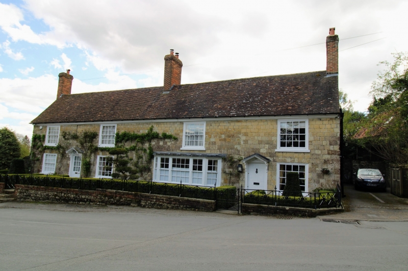
Terraced pair of houses. C18, extended twice to right. Uncoursed rubble stone plinth with red brick plinth band. Square coursed rubble. Eaves cornice to plain tiled roof with central ridge and end stacks. Two storeys; 4 windows, glazing bar sashes. Canted bay window, second, window from right. Entrances near-central to both houses to left half-glazed door with pediment on brackets over. To right panelled door with pediment on brackets over.
Listing NGR: TQ6020953610
External links are from the relevant listing authority and, where applicable, Wikidata. Wikidata IDs may be related buildings as well as this specific building. If you want to add or update a link, you will need to do so by editing the Wikidata entry.


Other nearby listed buildings