Approximate Location Map
Large Map »
Latitude: 51.2087 / 51°12'31"N
Longitude: 0.7931 / 0°47'35"E
OS Eastings: 595192
OS Northings: 149209
OS Grid: TQ951492
Mapcode National: GBR RW0.3BQ
Mapcode Global: VHKK6.PWM8
Plus Code: 9F326Q5V+F6
Entry Name: The Firs
Listing Date: 10 October 1980
Grade: II
Source: Historic England
Source ID: 1362593
English Heritage Legacy ID: 180795
ID on this website: 101362593
Location: Charing, Ashford, Kent, TN27
County: Kent
District: Ashford
Civil Parish: Charing
Built-Up Area: Charing
Traditional County: Kent
Lieutenancy Area (Ceremonial County): Kent
Tagged with: Architectural structure
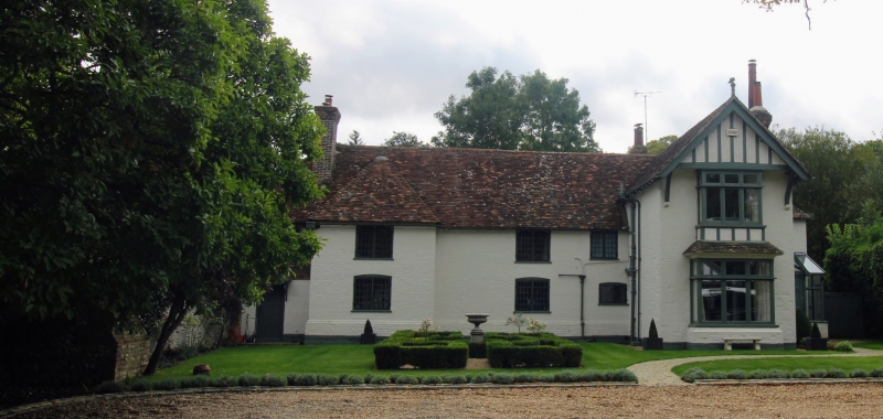
1.
5272 CHARING STATION ROAD
The Firs
TQ 9549 22/50
II
2.
The original portion is the north-east wing. C17. Two storeys painted red
brick, the first floor of the north-easternmost window bay tile-hung. The
next window bay to the south-west projects with a hip over. Hipped tiled roof.
Casement windows with small square leaded panes. At the west end is a C19
addition forming an L-projection to the north.
Listing NGR: TQ9519249209
External links are from the relevant listing authority and, where applicable, Wikidata. Wikidata IDs may be related buildings as well as this specific building. If you want to add or update a link, you will need to do so by editing the Wikidata entry.


Other nearby listed buildings
