Approximate Location Map
Large Map »
Latitude: 51.1932 / 51°11'35"N
Longitude: 0.7259 / 0°43'33"E
OS Eastings: 590567
OS Northings: 147307
OS Grid: TQ905473
Mapcode National: GBR QTS.4BL
Mapcode Global: VHKKC.J8MM
Plus Code: 9F325PVG+79
Entry Name: Jonstone East and West
Listing Date: 10 October 1980
Grade: II
Source: Historic England
Source ID: 1362619
English Heritage Legacy ID: 180840
ID on this website: 101362619
Location: Egerton, Ashford, Kent, TN27
County: Kent
District: Ashford
Civil Parish: Egerton
Traditional County: Kent
Lieutenancy Area (Ceremonial County): Kent
Tagged with: Architectural structure
1.
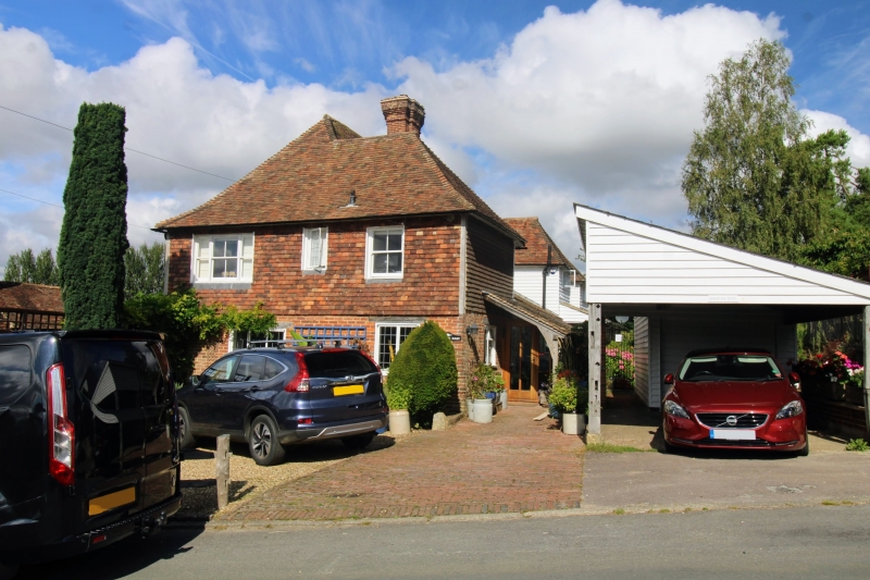
5272 EGERTON LOWER STREET
Jonstone East and West
TQ 94 NW 10/11
II
2.
C16 or earlier. Timber-framed close-studded building with plaster infilling,
the ground floor rebuilt in red brick. Hipped tiled roof. Two sashes with
glazing bars intact. Modern shop-front to the south-east wall. Rear part
is weatherboarded.
Listing NGR: TQ9056647298
External links are from the relevant listing authority and, where applicable, Wikidata. Wikidata IDs may be related buildings as well as this specific building. If you want to add or update a link, you will need to do so by editing the Wikidata entry.


Other nearby listed buildings
