Approximate Location Map
Large Map »
Latitude: 51.1454 / 51°8'43"N
Longitude: 0.6827 / 0°40'57"E
OS Eastings: 587743
OS Northings: 141885
OS Grid: TQ877418
Mapcode National: GBR QV9.5DQ
Mapcode Global: VHJN2.SG9R
Plus Code: 9F324MWM+53
Entry Name: Owlcroft
Listing Date: 10 October 1980
Grade: II
Source: Historic England
Source ID: 1362696
English Heritage Legacy ID: 181189
ID on this website: 101362696
Location: Smarden, Ashford, Kent, TN27
County: Kent
District: Ashford
Civil Parish: Smarden
Built-Up Area: Smarden
Traditional County: Kent
Lieutenancy Area (Ceremonial County): Kent
Tagged with: Building
1.
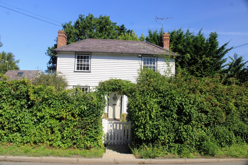
5272 SMARDEN BIDDENDEN ROAD
Owlcroft
TQ 8741 30/24
II
2.
Early C19. Two storeys. Ground floor painted brick, above weatherboarded.
Hipped slate roof. Two sashes with glazing bars intact. Small Tuscan porch.
Listing NGR: TQ8774341885
External links are from the relevant listing authority and, where applicable, Wikidata. Wikidata IDs may be related buildings as well as this specific building. If you want to add or update a link, you will need to do so by editing the Wikidata entry.


Other nearby listed buildings
