Approximate Location Map
Large Map »
Latitude: 51.1138 / 51°6'49"N
Longitude: 0.8143 / 0°48'51"E
OS Eastings: 597081
OS Northings: 138716
OS Grid: TQ970387
Mapcode National: GBR RX6.2PD
Mapcode Global: VHKKT.28CG
Plus Code: 9F324R77+GP
Entry Name: Criol Farmhouse
Listing Date: 10 October 1980
Grade: II
Source: Historic England
Source ID: 1362707
English Heritage Legacy ID: 181138
ID on this website: 101362707
Location: Stubb's Cross, Ashford, Kent, TN26
County: Kent
District: Ashford
Civil Parish: Shadoxhurst
Traditional County: Kent
Lieutenancy Area (Ceremonial County): Kent
Tagged with: Farmhouse
1.
5272 SHADOXHURST CHART ROAD
Criol Farmhouse
TQ 93 NE 19/12
II
2.
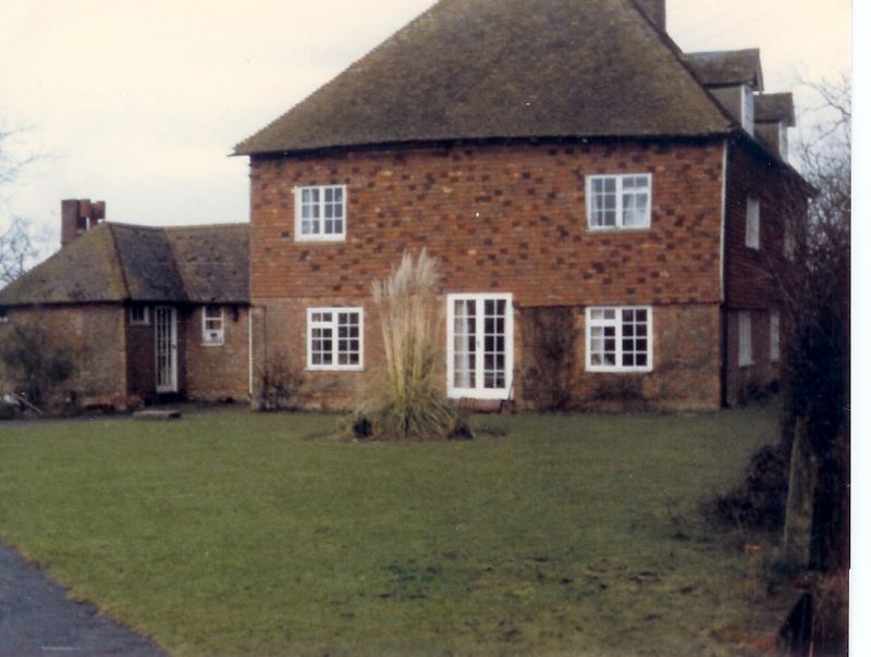
C13 exterior with some older work inside. Two storeys and attics. Ground
floor red brick, above tile-hung. Two gabled dormers. Two casement windows.
C19 gabled red brick porch. In the C18 the house was the residence of the
Molloy family. Captain Sir Charles Molloy RN (1684-1760) is buried in the
churchyard of Church of St Peter and St Paul (qv) and has a monument in the
church.
Listing NGR: TQ9708138716
External links are from the relevant listing authority and, where applicable, Wikidata. Wikidata IDs may be related buildings as well as this specific building. If you want to add or update a link, you will need to do so by editing the Wikidata entry.


Other nearby listed buildings
