Approximate Location Map
Large Map »
Latitude: 51.0666 / 51°3'59"N
Longitude: 0.6837 / 0°41'1"E
OS Eastings: 588131
OS Northings: 133121
OS Grid: TQ881331
Mapcode National: GBR QW8.5N2
Mapcode Global: FRA D6B9.D60
Plus Code: 9F323M8M+JF
Entry Name: 1-10, Mayor's Place
Listing Date: 8 April 1970
Grade: II
Source: Historic England
Source ID: 1362820
English Heritage Legacy ID: 179777
ID on this website: 101362820
Location: Tenterden, Ashford, Kent, TN30
County: Kent
District: Ashford
Civil Parish: Tenterden
Built-Up Area: Tenterden
Traditional County: Kent
Lieutenancy Area (Ceremonial County): Kent
Tagged with: Building
1.
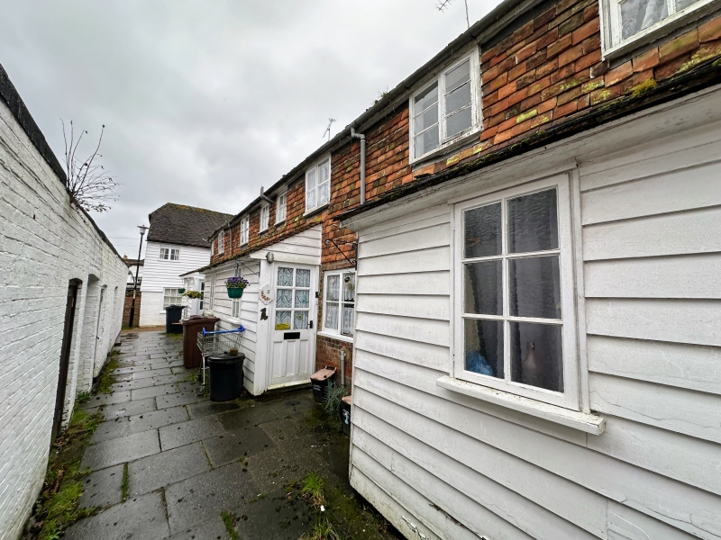
1715 MAYOR'S PLACE
Nos 1 to 10 (consec)
TQ 8833 1/155 8.4.70.
II GV
2.
C18 terrace. 2 storeys. 1st floor is faced with clay tiles. Ground floor
is brick. Tiled roof with 5 later brick chimneystacks. 10 Cl9 casements and
simple doors set in recessed moulded architraves. Graded II for group value.
Forms a group with Nos 1 and 2 Burgess Row
Listing NGR: TQ8814633128
External links are from the relevant listing authority and, where applicable, Wikidata. Wikidata IDs may be related buildings as well as this specific building. If you want to add or update a link, you will need to do so by editing the Wikidata entry.


Other nearby listed buildings
