Latitude: 51.1498 / 51°8'59"N
Longitude: 0.8704 / 0°52'13"E
OS Eastings: 600849
OS Northings: 142869
OS Grid: TR008428
Mapcode National: GBR RWP.YP1
Mapcode Global: VHKKN.1CHD
Plus Code: 9F324VXC+W5
Entry Name: 3, Castle Street
Listing Date: 4 June 1976
Last Amended: 29 July 1976
Grade: II
Source: Historic England
Source ID: 1362842
English Heritage Legacy ID: 179888
ID on this website: 101362842
Location: St George's Square, Ashford, Kent, TN23
County: Kent
District: Ashford
Electoral Ward/Division: Victoria
Parish: Non Civil Parish
Built-Up Area: Ashford (Ashford)
Traditional County: Kent
Lieutenancy Area (Ceremonial County): Kent
Tagged with: Building
This list entry was subject to a Minor Amendment on 15/01/2013
TR 0042 NE 2/167
5344
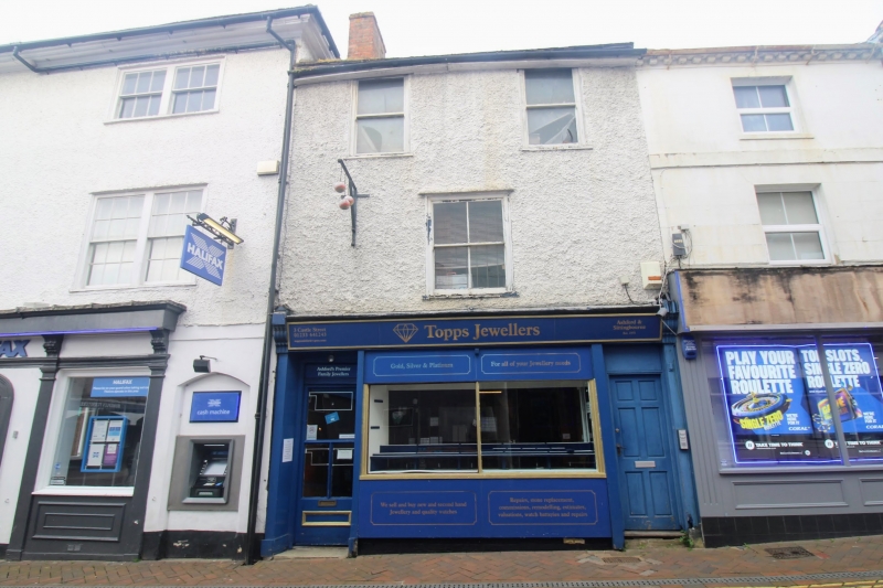
CASTLE STREET (West Side)
No 3
(Formerly listed as No 13)
GV
II
C18. 3 storeys pebble-dashed. Hipped tiled roof. 2 sashes to 2nd floor; 1 sash
to 1st floor without glazing bars. Ground floor has C19 shop front.
Nos 1 to 15 (odd) form a group with Nos 1 to 7 (odd) New Street. Nos 5 to 13 (odd)
Castle Street are of local interest.
Listing NGR: TR0084942869
External links are from the relevant listing authority and, where applicable, Wikidata. Wikidata IDs may be related buildings as well as this specific building. If you want to add or update a link, you will need to do so by editing the Wikidata entry.


Other nearby listed buildings