Approximate Location Map
Large Map »
Latitude: 51.1253 / 51°7'30"N
Longitude: 0.6151 / 0°36'54"E
OS Eastings: 583090
OS Northings: 139472
OS Grid: TQ830394
Mapcode National: GBR QVF.6BY
Mapcode Global: VHJN1.MZ08
Plus Code: 9F324JG8+42
Entry Name: Common Farmhouse
Listing Date: 16 August 1962
Grade: II
Source: Historic England
Source ID: 1362868
English Heritage Legacy ID: 180120
ID on this website: 101362868
Location: Hareplain, Ashford, Kent, TN27
County: Kent
District: Ashford
Civil Parish: Biddenden
Traditional County: Kent
Lieutenancy Area (Ceremonial County): Kent
Tagged with: Farmhouse
BIDDENDEN
1.
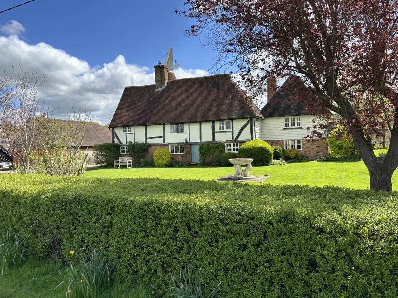
5272 Common Farmhouse,
Hare Plain
TQ 83 NW 3/103 16.8.62.
II
2.
A C16 or earlier timber-framed building with plaster infilling and curved
braces, the ground floor rebuilt in red brick. Two storeys. Tiled roof,
hipped at the south end. Two casement windows. The rear elevation has a cylindrical
brick oast attached.
Listing NGR: TQ8309039472
External links are from the relevant listing authority and, where applicable, Wikidata. Wikidata IDs may be related buildings as well as this specific building. If you want to add or update a link, you will need to do so by editing the Wikidata entry.


Other nearby listed buildings
