Approximate Location Map
Large Map »
Latitude: 51.2555 / 51°15'19"N
Longitude: 0.4089 / 0°24'32"E
OS Eastings: 568192
OS Northings: 153464
OS Grid: TQ681534
Mapcode National: GBR NPY.86Q
Mapcode Global: VHJMC.1PJW
Plus Code: 9F327C45+6H
Entry Name: Barn 20 Yards North West of Manor Farmhouse
Listing Date: 19 April 1985
Grade: II
Source: Historic England
Source ID: 1363049
English Heritage Legacy ID: 178918
ID on this website: 101363049
Location: Pizien Well, Tonbridge and Malling, Kent, ME18
County: Kent
District: Tonbridge and Malling
Civil Parish: Wateringbury
Built-Up Area: Wateringbury
Traditional County: Kent
Lieutenancy Area (Ceremonial County): Kent
Church of England Parish: Wateringbury St John the Baptist
Church of England Diocese: Rochester
Tagged with: Barn
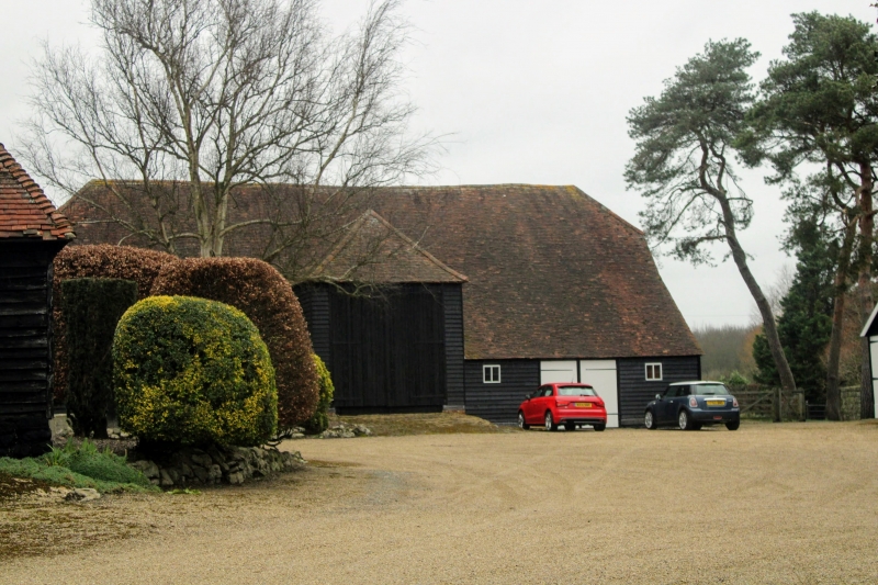
TQ 65 SE WATERINGBURY OLD ROAD
(north side)
2/89 Barn 20 yards north-
west of Manor Farm-
- house
GV II
Barn C19. Weather-boarded with hipped tiled roof. South wagon entrance.
Catslide to south. Included for group value
Listing NGR: TQ6819253464
External links are from the relevant listing authority and, where applicable, Wikidata. Wikidata IDs may be related buildings as well as this specific building. If you want to add or update a link, you will need to do so by editing the Wikidata entry.


Other nearby listed buildings
