Approximate Location Map
Large Map »
Latitude: 51.2637 / 51°15'49"N
Longitude: 0.4264 / 0°25'35"E
OS Eastings: 569382
OS Northings: 154409
OS Grid: TQ693544
Mapcode National: GBR NPS.LNG
Mapcode Global: VHJMC.BHSM
Plus Code: 9F327C7G+FH
Entry Name: Barn 40 Yards North of Red Hill Farmhouse
Listing Date: 19 April 1985
Grade: II
Source: Historic England
Source ID: 1363051
English Heritage Legacy ID: 178935
ID on this website: 101363051
Location: Red Hill, Tonbridge and Malling, Kent, ME18
County: Kent
District: Tonbridge and Malling
Civil Parish: Wateringbury
Traditional County: Kent
Lieutenancy Area (Ceremonial County): Kent
Church of England Parish: Wateringbury St John the Baptist
Church of England Diocese: Rochester
Tagged with: Barn
TQ 65 SE WATERINGBURY RED HILL
(west side)
2/100 Barn 40 yards north of
Red Hill Farmhouse
-
GV II
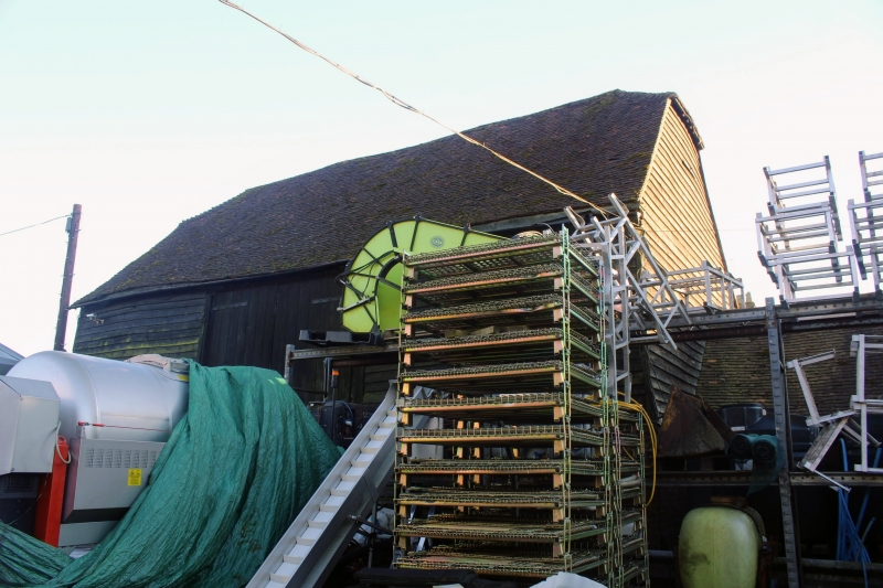
Barn. Mid C19. Weather-boarded on brick base with half-hipped plain tiled roof.
3 bays with central wagon entrance to north. Included for group value.
Listing NGR: TQ6921053534
External links are from the relevant listing authority and, where applicable, Wikidata. Wikidata IDs may be related buildings as well as this specific building. If you want to add or update a link, you will need to do so by editing the Wikidata entry.


Other nearby listed buildings
